0425L-THURSDAY OUTLOOK & INFO FROM GARFIELD COUNTY EMERGENCY MGMT-6/11/2020
1- THE HEAT RETURNS along with the high pressure dome we enjoyed last week. Winds have returned from the south so you’ll notice the humidity returning this afternoon. Overall, weather-wise, not too much happening.
2- Fire-wise- continue to be careful out there and you’ll probably see many fires as some farmers will be burning there fields since they got their wheat cut. We’ll continue to coordinate with our 911 dispatch on fires so I will say this, if you see smoke and fire, call 911. They should know where controlled burns are if they are called in properly. FARMERS, PLEASE CALL YOUR BURNING IN.
3-Several rural departments were called out yesterday to assist fighting fires in Grant County early yesterday and then large fires in eastern Major County yesterday afternoon. That was a wild ride out there for a while. We sent a task force out to Central Major County PER REQUEST and we’ll see how today sizes up.
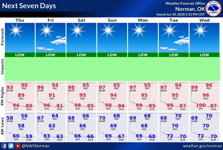
4- Here is your forecast from the NWS/NORMAN;
Today-Sunny with a high near 95. South winds 5 to 15 mph, with gusts as high as 20 mph.
Tonight-Mostly clear with a low around 66. South winds 10 to 15 mph gusting to 20 mph.
HAVE A GREAT DAY!!
MIKE