0340L-FRIDAY OUTLOOK & INFO FROM GARFIELD COUNTY EMERGENCY MGMT-6/19/2020
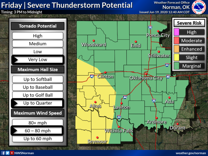
1- MARGINAL RISK for severe weather today across most of the area with a slight risk in SW OKLAHOMA. The main risk for us looks to be torrential rainfall along with strong winds. Storms could occur just about anytime during the day and tonight. A slow moving front is the cause for this so hopefully we see that rainfall.
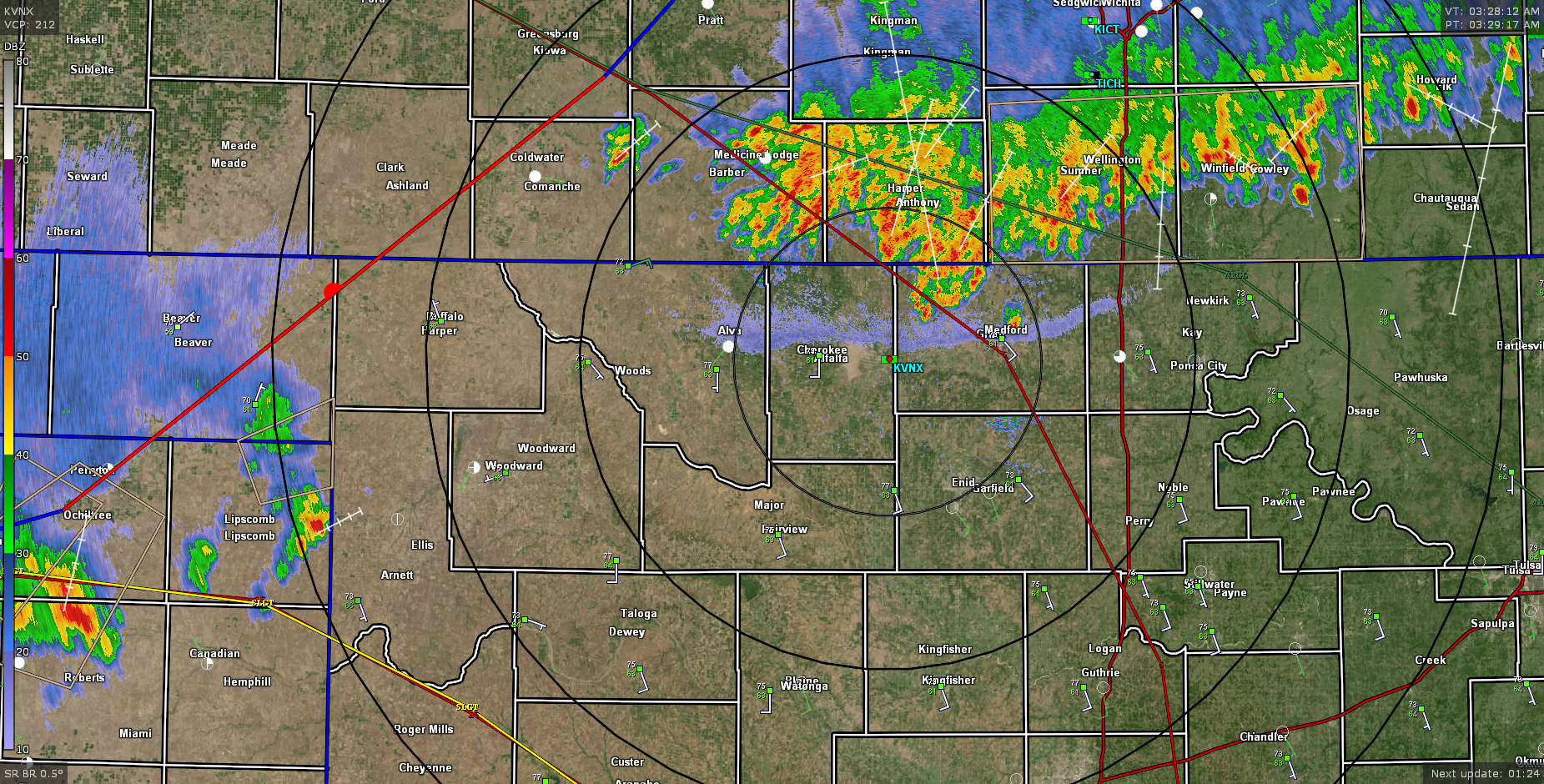
2- AT 0330 this morning we have thunderstorms in southern Kansas that are slowly moving into northern Alfalfa, Grant, and Kay counties. Hopefully these storms will move in a through Garfield County a little later. The radar pic attached is from 0330 local time off of the Vance WSR-88D weather radar. If you look from Alva to Cherokee to Medford, you’ll see an outflow boundary where cooler winds and maybe some additional storms could fire up. We’ll see what happens over the short term this morning.
3- The FIRE DANGER will still be a hazard today, especially if it doesn’t rain. Higher humidity and lighter winds should help keep the danger in check. We’ll hope for that rain. Another fire on North 54th yesterday kept Enid Fire, Fairmont, Breckinridge, Hunter, Kremlin, and Hillsdale- Carrier busy for a while yesterday afternoon. Low humidity and strong winds were a major factor in this one. Thanks for all the help once again to these departments. Enid and Rural Fire commands worked very well together once again. Personally, I think every fire department in the county needs a rest.
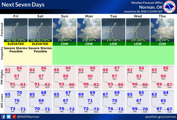
Here is your forecast from the NWS/NORMAN;
Today-Mostly cloudy with thunderstorms likely. Highs in the mid-80s. Southeast winds 10 to 15 mph. Chance of thunderstorms 70 percent.
Tonight-Mostly cloudy with a chance of thunderstorms. Lows in the mid-60s. Southeast winds around 10 mph. Chance of thunderstorms 50 percent.
HAVE A GOOD DAY!!
MIKE