0405L-SATURDAY OUTLOOK & INFO FROM GARFIELD COUNTY EMERGENCY MGMT-6/20/2020
1- MARGINAL RISK for severe weather to our south, if traveling south, stay weather aware wherever you may be going. We received 1.7 inches of rainfall here in Enid so let me know your totals too from yesterday. Some areas around Hillsdale received around 3 inches. We needed rain but not all at once!! That’s ok though, we take it!
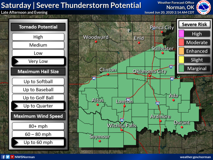
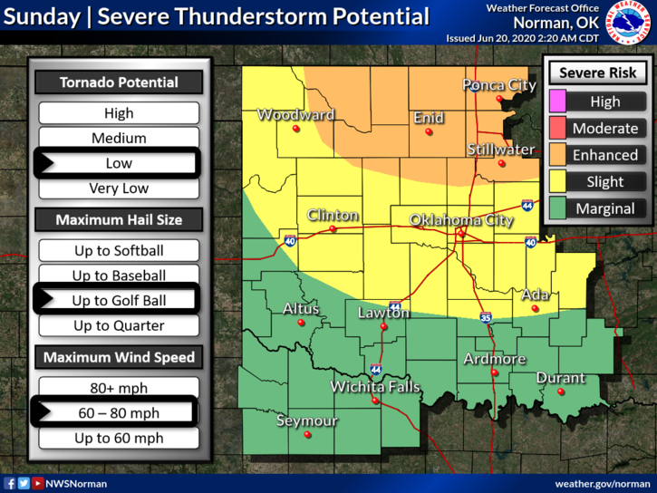
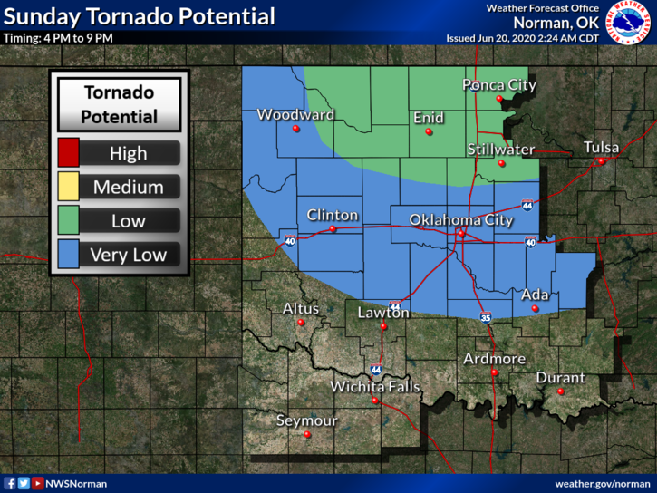
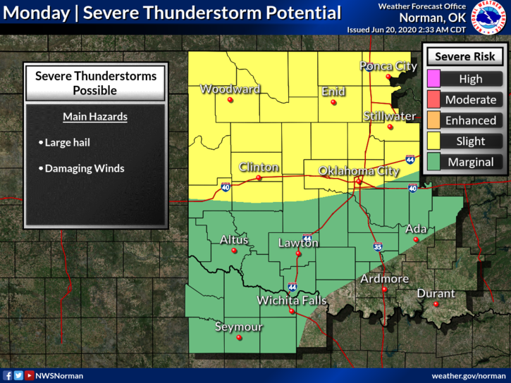
2- I attached several graphics to this post. Read them carefully. Sunday, we are in an ENHANCED RISK along with a LOW risk for TORNADOES. Monday, we’ll be in a SLIGHT RISK for additional severe weather. With all this mess, just stay weather aware and we’ll send updates over our GARFIELD COUNTY EM APP as we need too. Remember that the NWS sends all warnings through our app too.
3- Here is your forecast from the NWS/NORMAN;
Today-20% chance of thunderstorms & warmer. Highs in the upper 80s with light and variable winds becoming southwest around 10 mph in the afternoon.
Tonight-Partly cloudy with a slight chance of thunderstorms. Lows in the mid-60s. South winds around 10 mph in the evening becoming light and variable. Chance of thunderstorms 20 percent.
HAVE A GOOD DAY AND READ THE ATTACHED GRAPHICS CAREFULLY. These will change some as we progress through the weekend. BE PREPARED, NOT SCARED!
MIKE