405L-FRIDAY UPDATE FROM ENID/GARFIELD COUNTY EMERGENCY MANAGEMENT-6/29/18
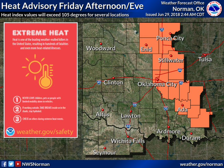
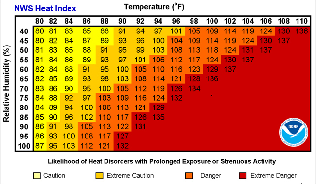
1- HEAT ADVISORY AGAIN TODAY FROM 1PM UNTIL 9PM TONIGHT. HEAT INDEX VALUES TO 106 ARE POSSIBLE. USE “EXTREME” CAUTION WHILE WORKING OUTSIDE.
2-Thunderstorms may be rolling back into the forecast later today out west and then into our area by means of a front Saturday evening. Timing right now is an issue so stay weather aware. If storms occur, downburst winds and isolated hail would be the main threats. DOWNBURST WINDS are the key words here.
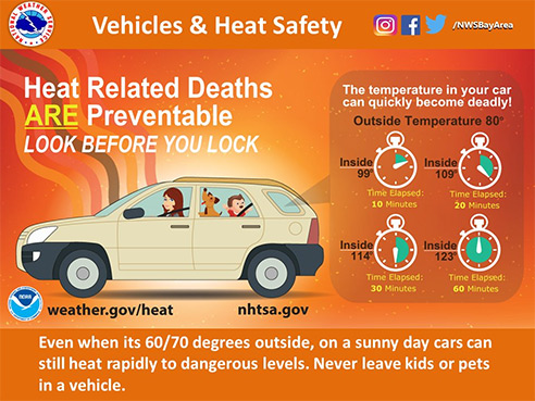
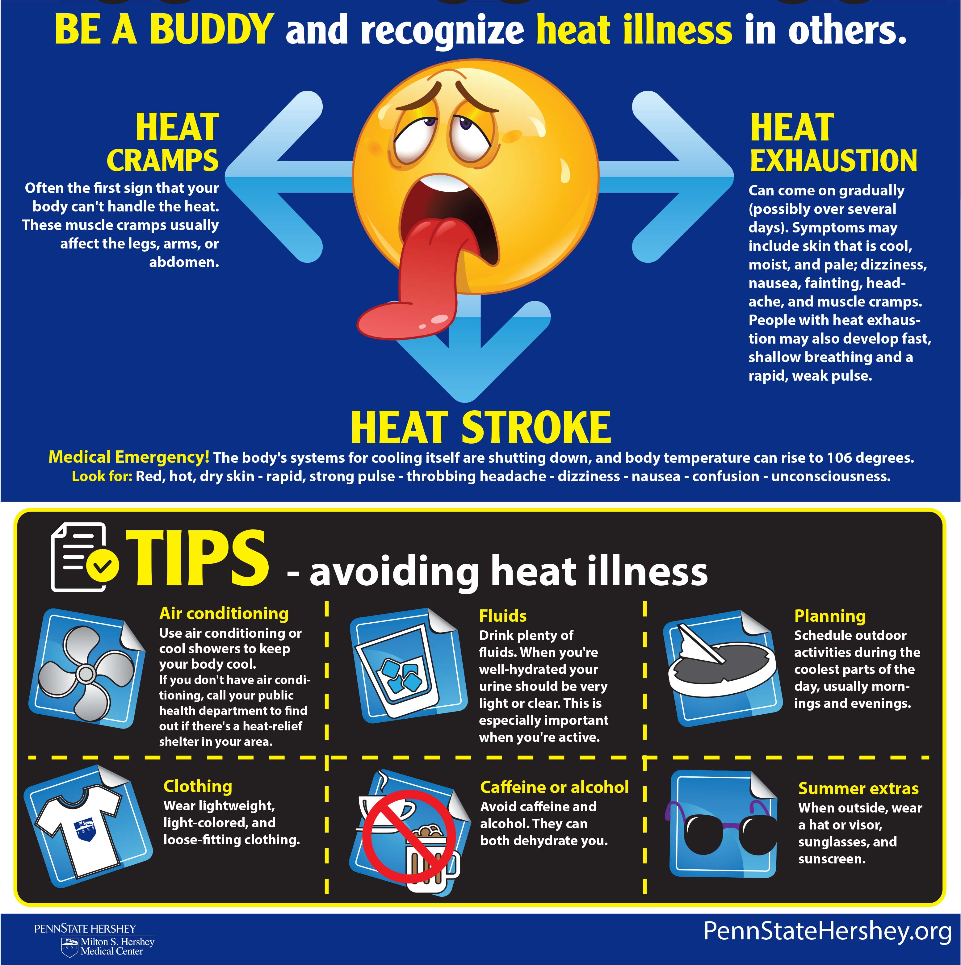
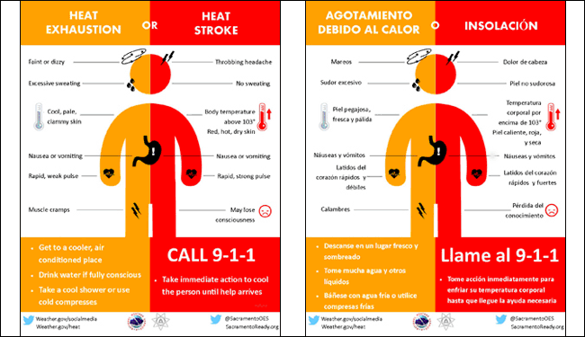
3-Overall, we’ll be ok but remember the signs for heat related illnesses. This is NOT a game and It doesn’t matter if you work outside or not. IMPROPER HYDRATION will hurt you and you may not realize it until it’s too late. Again, use extreme caution while working outdoors.
4- Here is your forecast from the NWS/NORMAN;
Friday-Sunny and hot with highs near 98. Heat index values around 104. South winds 15-20 gusting to 25 mph.
Friday Night-Mostly clear with lows around 78. South winds 15-20 mph gusting to 25 mph.
HAVE A GREAT DAY AND STAY COOL.
MIKE