1-HEAT ADVISORY IN EFFECT FROM 1PM UNTIL 9PM.HEAT INDEX VALUES TO 106 POSSIBLE. Depending on conditions and the possibility of thunderstorms, this advisory may lapse before 9pm per NWS Guidance.
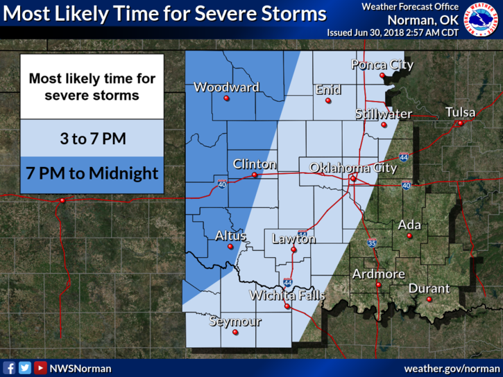
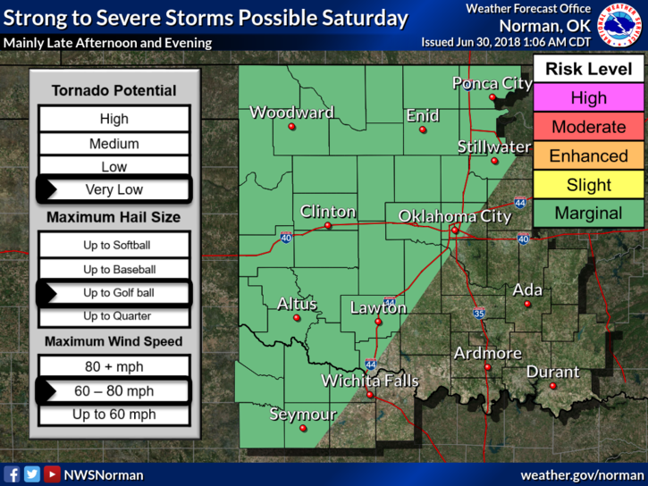
2- MARGINAL RISK FOR SEVERE WEATHER –RISKS: WINDS-60-80 MPH, HAIL-UP TO GOLF BALL, AND THE TORNADO RISK IS VERY LOW. TIMING-3 PM TO 7 PM. Should see showers overnight, maybe.
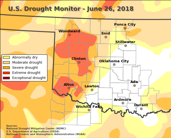
3-The Drought Monitor is out showing us in a split drought situation. East- abnormally dry, West- Moderate drought.
4-On the GARFIELD COUNTY EM app, since VAFB weather radar is down, use the REGIONAL button. It’s not as close, but it will give you an overall picture of the area. Also, all Garfield County spotters have been briefed on the radar situation and will deploy upon request.
5-Here is your forecast from the NWS/NORMAN;
Saturday-30 percent chance of showers and thunderstorms, mainly after 1pm. Partly sunny, with a high near 96. Heat index values as high as 104. South wind 15 to 20 mph gusting to 25 mph.
Saturday Night- chance of showers and thunderstorms, then showers likely and possibly a thunderstorm after 1am. Cloudy, with a low around 71. South winds 5 to 15 mph gusting to 25 mph. Chance of precipitation is 70%. New rainfall amounts between a half and three quarters of an inch possible.
HAVE A GREAT DAY!!
MIKE