0415L-FRIDAY UPDATE FROM ENID/GARFIELD COUNTY EMERGENCY MANAGEMENT-3/30/18
1- A cold front will affect the area Saturday afternoon bringing much COLDER air into the area. Sunday mornings low may be near freezing. Keep a jacket in the car and remember to bundle up the kids. They get cold too.
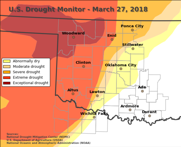
2- The DROUGHT MONITOR graph is attached and as you can see, even with the rain we’ve had, didn’t affect it very much. We still need more rain so hopefully we’ll see some more in the up and coming weeks. The county is still split between a severe and extreme drought conditions. Be careful!!
3- MARK your calendars; OCTOBER 30, 2018 will be our 2nd Annual DISASTER RESILIENCE SEMINAR. Last year’s event went really well and this one will be even better. 4 of 6 speakers are already booked. This event is open to the public, school officials and teachers, government officials, and anyone else who would like to attend. Details coming over the next several months.
4-REMINDER; STORM SEASON IS UPON US. There is never a reason to panic. Getting yourself and your family PREPARED isn’t difficult. People make it difficult. The first step is understanding what’s going on or what we think may happen. Download our EMERGENCY APP-GARFIELD COUNTY EM- and you will get information directly from us. Our preparedness guide is here: https://gcem.org/wp-content/uploads/2017/08/Garfield-County-Family-Preparedness-Guide-2017.pdf No excuses now!!
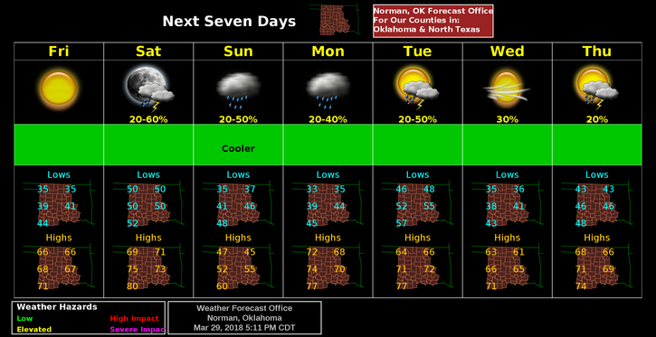
5- Here is your forecast from the NWS/NORMAN;
Friday-Patchy frost before 9am. Otherwise, partly sunny, then gradually becoming sunny, with a high near 65. North wind 5 to 10 mph becoming south in the afternoon.
Friday Night-Mostly clear, with a low around 50. South wind 10 to 20 mph gusting to 24 mph.
HAVE A SUPER DAY!!
MIKE