0425L-FRIDAY UPDATE /OUTLOOK FROM ENID/GARFIELD COUNTY EMERGENCY MANAGEMENT-5/18/18
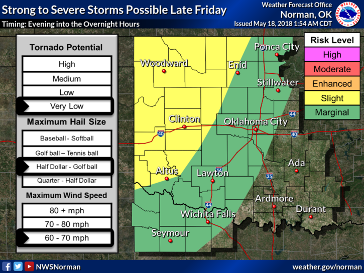
1-SLIGHT RISK FOR SEVERE WEATHER LATER THIS EVENING. IT APPEARS WE MAY NOT SEE ANY THUNDERSTORMS UNTIL LATE. THIS COULD CHANGE SO STAY AWARE.
2-MAIN RISKS– large hail, damaging winds, isolated tornadoes IF storms reach our area as discreet supercells. This is unlikely but possible. Storms may reach our area as a squall line. This won’t make the tornado threat zero but it will lessen it somewhat. Don’t sweat the “T” thing right now. We’ll be ok.
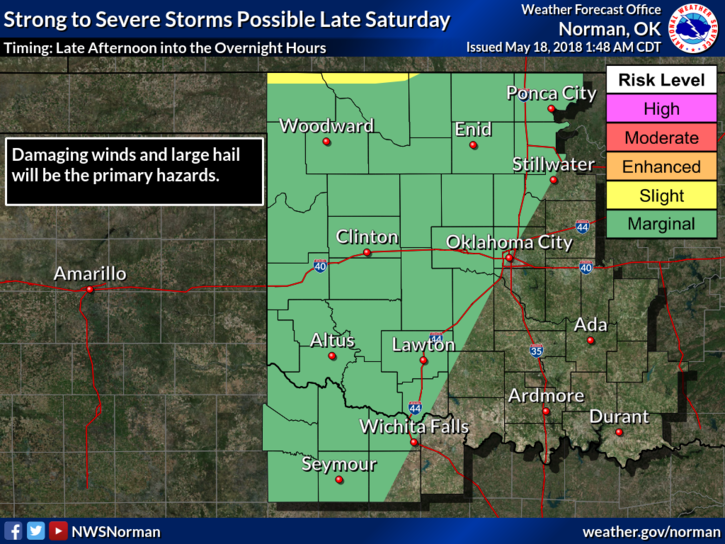
3-With hail and winds being the main threats later today, these will also be our threats on Saturday. We are dealing with a cold front that’s forecast to come through later on Saturday, a dryline, and all the mess that comes with it. The key factor here is just stay weather aware later today and Saturday late afternoon into the evening and we’ll deal with it.
4- Over all, we’ll be just fine but we’ll need to watch closely as evening comes upon us. If ballgames are ongoing don’t be surprised if you hear my voice asking for fields to be vacated. This would be an extreme condition but understand my priority is you. Public Safety is important when folks know its coming and they all get tunnel vision to get that game in. We’ll see what happens.
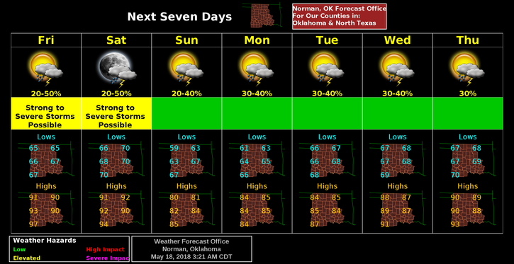
5- Here is your forecast from the NWS/NORMAN;
Today… partly cloudy. a slight chance of showers and thunderstorms this morning. highs around 90. southeast winds 10 to 20 mph. chance of precipitation 20 percent.
Tonight… partly cloudy with a slight chance of showers and thunderstorms. lows in the upper 60s. southeast winds around 15 mph. chance of precipitation 20 percent
HAVE A SUPER DAY!!
MIKE