0445L-SATURDAY OUTLOOK/UPDATE FROM ENID/GARFIELD COUNTY EMERGENCY MANAGEMENT-5/19/18
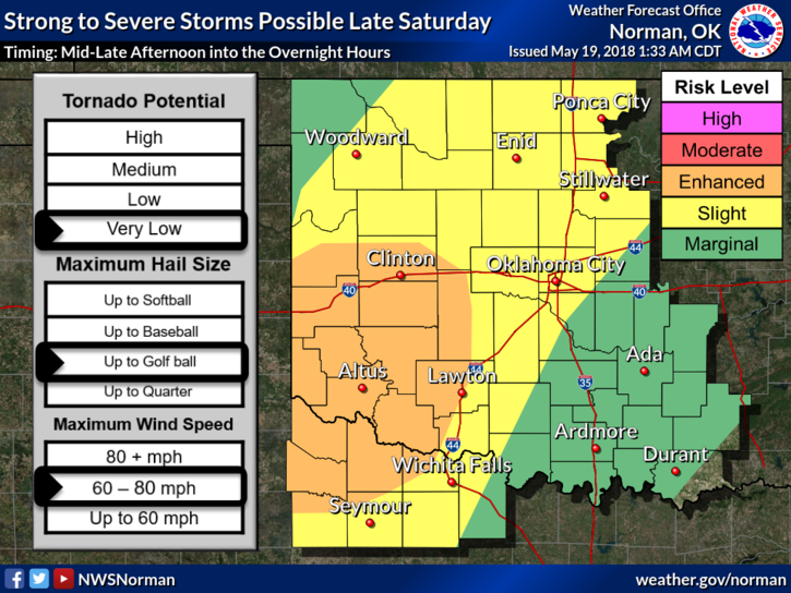
1- WE ARE IN A SLIGHT RISK AND VERY CLOSE TO THE ENHANCED RISK, NORTH OF US PER SPC, FOR SEVERE WEATHER LATER TODAY. There is a cold front and dryline involved in all this mess so you really should pay very close attention to weather conditions today.
2– HIGH WINDS AND LARGE HAIL WILL BE THE MAIN THREATS. TIMING APPEARS TO BE FROM 4PM SATURDAY UNTIL 3 AM SUNDAY MORNING.
3- Overnight we experienced strong winds and heavy rainfall in a short amount of time and this may occur today as the storms along the front and dryline push through the area. Per guidance, we may see storm form pretty close so just be prepared and have a plan to take cover if this happens.
4- Overall, we’ll be OK so just stay weather aware and we’ll send out info as needed over our GARFIELD COUNTY EM app and social media.
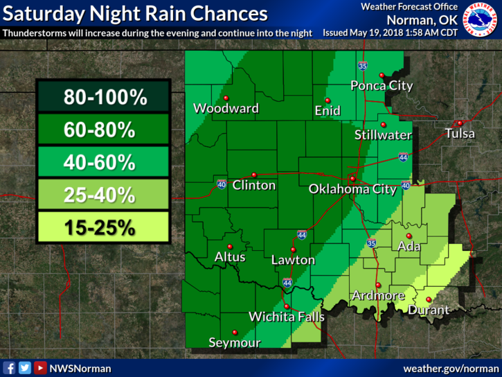
5- Here is your forecast from the NWS/NORMAN;
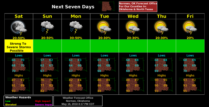
Saturday-Slight chance of showers and thunderstorms before 10am, then a slight chance of showers and thunderstorms after 1pm. Mostly sunny, with a high near 90. South southwest wind 10 to 16 mph, with gusts as high as 23 mph. Chance of precipitation is 20%.
Saturday Night-Showers and thunderstorms likely. Some of the storms could be severe. Mostly cloudy, with a low around 58. South wind 7 to 14 mph becoming north after midnight. Winds could gust as high as 20 mph. Chance of precipitation is 60%. New rainfall amounts between three quarters and one inch possible.
HAVE A GREAT DAY!!
MIKE