0425L-THURSDAY OUTLOOK FROM ENID/GARFIELD COUNTY EMERGENCY MANAGEMENT-5/17/18
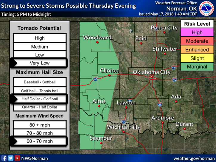
1- We are in a GENERAL THUNDERSTORM RISK today. This means that even though the higher risk is out west today, we can still have scattered showers and thunderstorms. The main risks would be hail and winds. Don’t change your plans but just keep an eye to the sky.
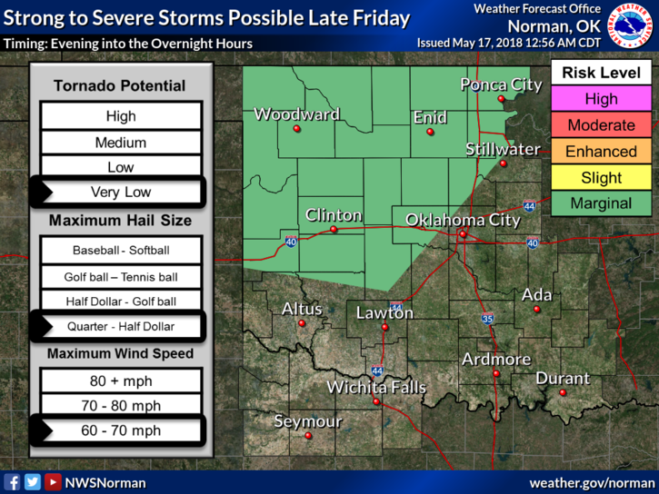
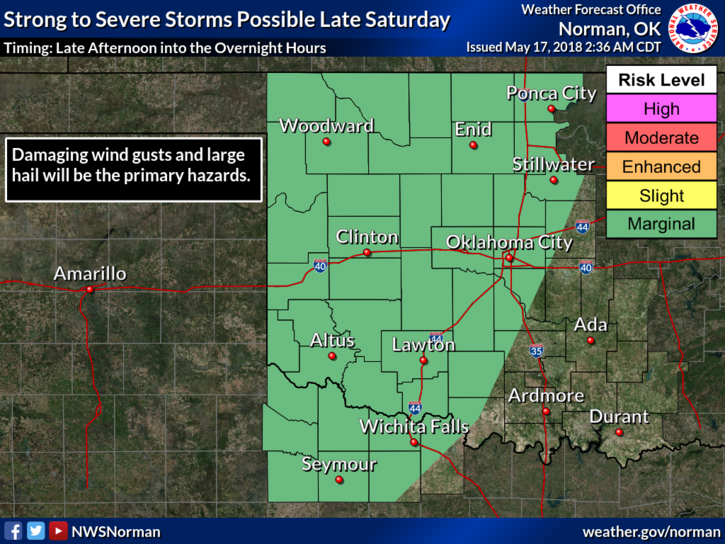
2- We’ll continue with a MARGINAL RISK on Friday and then on SATURDAY, it wouldn’t surprise me to see us go from the Marginal Risk, which is forecast, to a SLIGHT RISK or ENHANCED RISK. We’ll see how this mess out there comes together.
3-If storms end up over your area, they will produce a lot of rainfall and localized flooding could occur so keep that in mind too. OVERALL, we’ll be ok.
4-I almost forgot to mention that decaying thunderstorms could put out very strong winds that could mix to the surface. Some of these winds can produce damage here on the surface so secure things around the house that could take fight in the event storms occur in your respective areas.
5-Be sure and download our GARFIELD COUNTY EM app. If you don’t have it, you’re not prepared.
6- Here is your forecast from the NWS/NORMAN;
Today-Partly cloudy. Patchy fog early this morning. A slight chance of showers and thunderstorms this afternoon. Highs in the mid 80s. Light and variable winds becoming southeast around 10 mph this afternoon. Chance of precipitation 20 percent.
Tonight-Partly cloudy with a slight chance of showers and thunderstorms. Lows in the mid 60s. Southeast winds around 10 mph. Chance of precipitation 20 percent.
HAVE A GREAT DAY!
MIKE