0340L-FRIDAY OUTLOOK FROM GARFIELD COUNTY EMERGENCY MANAGEMENT-11/13/2020
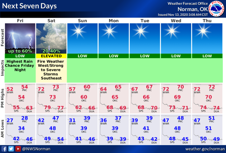
1-Cool today and a little warmer Friday night as another front pushes through the area. There MIGHT be some shower activity with this front tonight but in my opinion per guidance, don’t hold your breath. That said, another front will traverse the area late Saturday bringing strong north winds. This will increase the fire danger especially if we don’t see any precipitation.
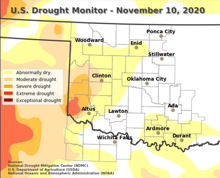
2- Overall, we’ll be ok but keep your eyes peeled for smoke and fire. We have trended back into abnormally dry conditions per the drought monitor now so this makes the Fire Danger a bit more prevalent. Call 911 if you see smoke and or fire.
3- Here is your forecast from the NWS/NORMAN;
Today- Partly cloudy. Highs in the lower 50s. Light and variable winds.
Tonight- Mostly cloudy with a chance of rain showers and isolated thunderstorms. Not as cool. Lows in the mid-40s. South winds 10 to 15 mph. Chance of precipitation 50 percent.
HAVE A GOOD DAY!!
MIKE
BE PREPARED with our GARFIELD COUNTY EM app. If you don’t have it, you WILL need it very soon. PREPAREDNESS= RESILIENCE