0325L-SATURDAY OUTLOOK FROM GARFIELD COUNTY EMERGENCY MANAGEMENT-11/14/2020
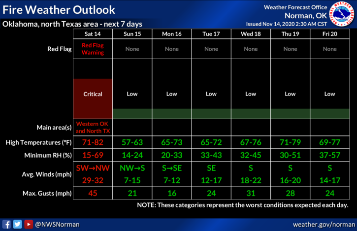
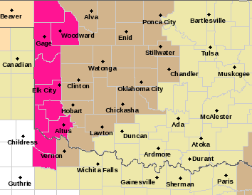
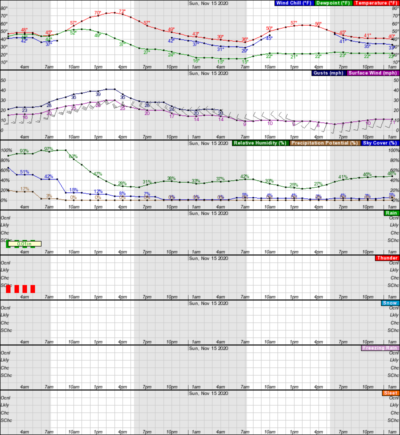
1- WIND ADVISORY in effect from 11am until 5pm today. Winds 25-35 mph with some gusts into the 40-45 mph range are possible. Winds this strong may bring down additional limbs that were weakened by the ice storm along with power lines. Whipping powerlines could be sparking and cause grass fires. If you see smoke or fire, CALL 911. If you see whipping and or sparking powerlines, call OGE at 800-522-6870. If possible, get the identification number from a power pole nearby. RED FLAG WARNING in effect for the western tier counties.
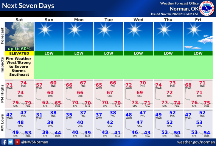
2- A front will push in late this afternoon shifting winds from the west-southwest to the west-northwest along with bringing colder temps with it. The Fire danger will be high today and tomorrow as dew point temps and humidity will be low along with strong and gusty winds.
3- Overall, a nice day if you like the wind. Here is your forecast from the NWS/NORMAN;
Saturday- Sunny with a high near 74. South winds 15 to 25 mph becoming southwest 25 to 30 mph in the afternoon. Winds could gust as high as 41 mph.
Saturday Night- Clear with a low around 36. Northwest wind 15 to 20 mph with gusts as high as 30 mph.
DIRECTOR’S COMMENT:
Download our GARFIELD COUNTY EM app and keep up with warnings and advisories from the NWS and us.
HAVE A GOOD DAY!!
MIKE