FROM GARFIELD COUNTY EMERGENCY MANAGEMENT-FRIDAY-11/17/17
BE SURE TO GET OUR EMERGENCY APP “GARFIELD COUNTY EM.” IT JUST MIGHT SAVE YOUR LIFE!
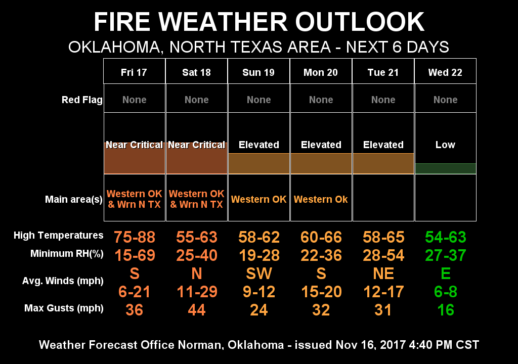
THE FIRE DANGER WILL BE NEAR CRITICAL THIS WEEKEND. BE CAREFUL OUT THERE.
THE NWS IN NORMAN HAS ISSUED A “WIND ADVISORY” FOR THE AREA FROM MIDNIGHT UNTIL 3 PM SATURDAY. SUSTAINED WINDS-25-30 MPH WITH GUSTS OVER 50 MPH ARE POSSIBLE. USE EXTREME CAUTION WHILE DRIVING LATER TONIGHT AND TOMORROW.
The above is due to a strong cold front that will push into the area later tonight. During the day we could possibly see wind gusts around 30mph. Later tonight is when the higher gusts will occur. SECURE ANY LOOSE PROPERTY around your house by later this evening. This assures it will be there in the morning and not in the neighbor’s yard.
Here is your forecast from the NWS/NORMAN;
Today: decreasing clouds and warmer. Patchy fog early this morning. Highs in the upper 70s. South winds 15 to 20 mph with gusts up to 30 mph.
Tonight: Partly cloudy and cooler. Lows in the upper 40s. Southwest winds 15 to 20 mph shifting to the west after midnight.
HAVE A GREAT DAY!
MIKE