0400L-FRIDAY OUTLOOK & INFO FROM GARFIELD COUNTY EMERGENCY MANAGEMENT-10/18/19
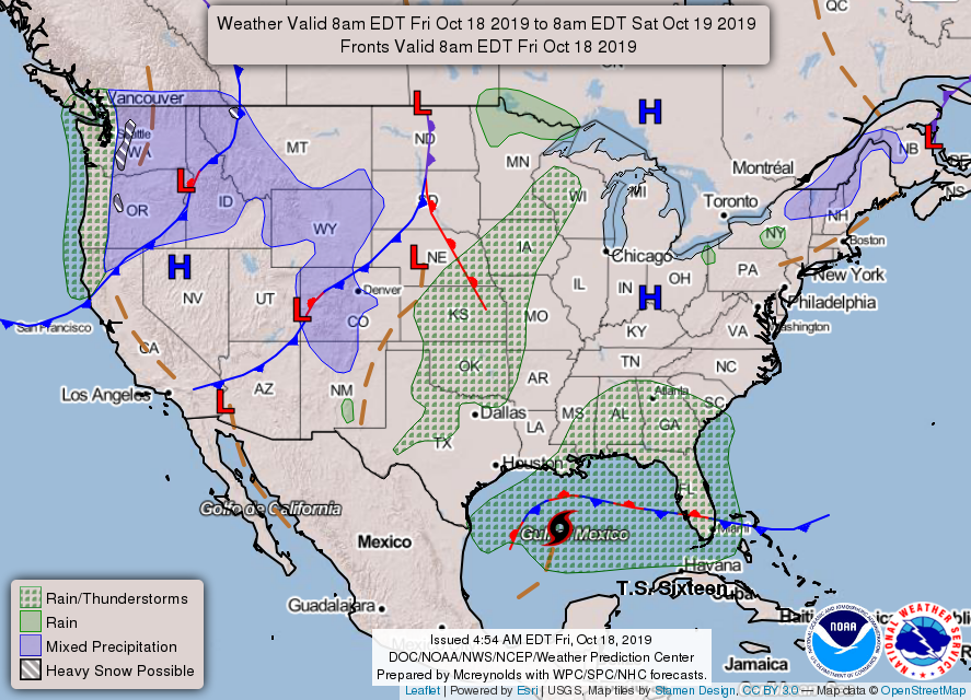
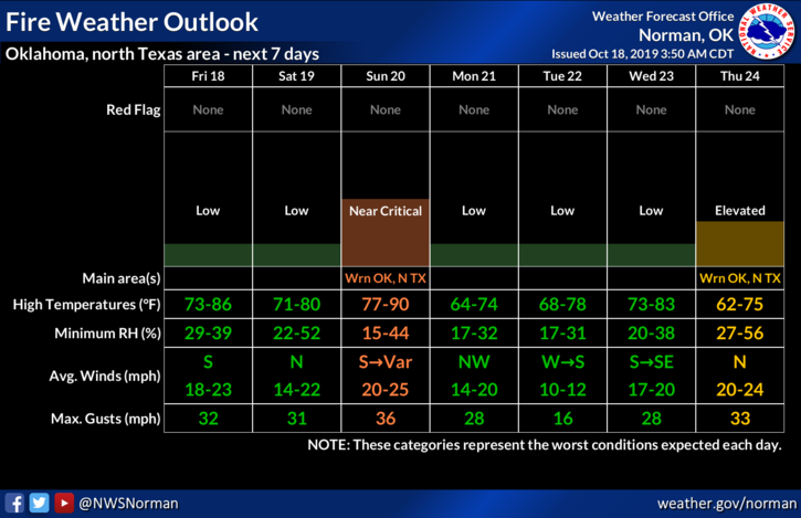
1- GENERAL THUNDERSTORM RISK later tonight as the front approaches and pushes through the area. Chances are low so we’ll see what develops. Make sure you have our GARFIELD COUNTY EM app so you can stay advised.
2- We will have several fronts push in and through the area over the next week so temps may fluctuate a bit so be prepared for that. There are many games going on tonight so we’ll keep an eye out and if school officials have questions, either call or use the app to contact me.
3- Here is your forecast from the NWS/NORMAN;
Friday-Sunny with a high near 77. Windy with south winds 15 to 20 mph increasing to 20 to 25 mph in the afternoon. Winds could gust as high as 36 mph.
Friday Night-40 percent chance of showers and thunderstorms late. Mostly cloudy with a low around 52. South southeast wind 15 to 25 mph becoming northwest 5 to 15 mph after midnight. Winds could gust as high as 35 mph.
HAVE A GREAT DAY!!
MIKE