0430L-SATURDAY OUTLOOK & INFO FROM GARFIELD COUNTY EMERGENCY MANAGEMENT-10/19/19
1- For all you weather nuts, Vance radar located at Salt Plains will be DOWN for approximately 3 weeks as technicians replace critical infrastructure within the radar. This is step 3 of 4 as part of a service life extension program. In the event of severe weather during this timeframe, we’ll utilize radars from Dodge City, Wichita, and Norman. This means we won’t see the lower levels of the atmosphere on radar so spotter deployment would become a stronger possibility depending on SEVERE conditions. We’ll play this by ear and our network of spotters will be briefed this morning. Don’t worry, this has occurred before, we’re prepared on our end.
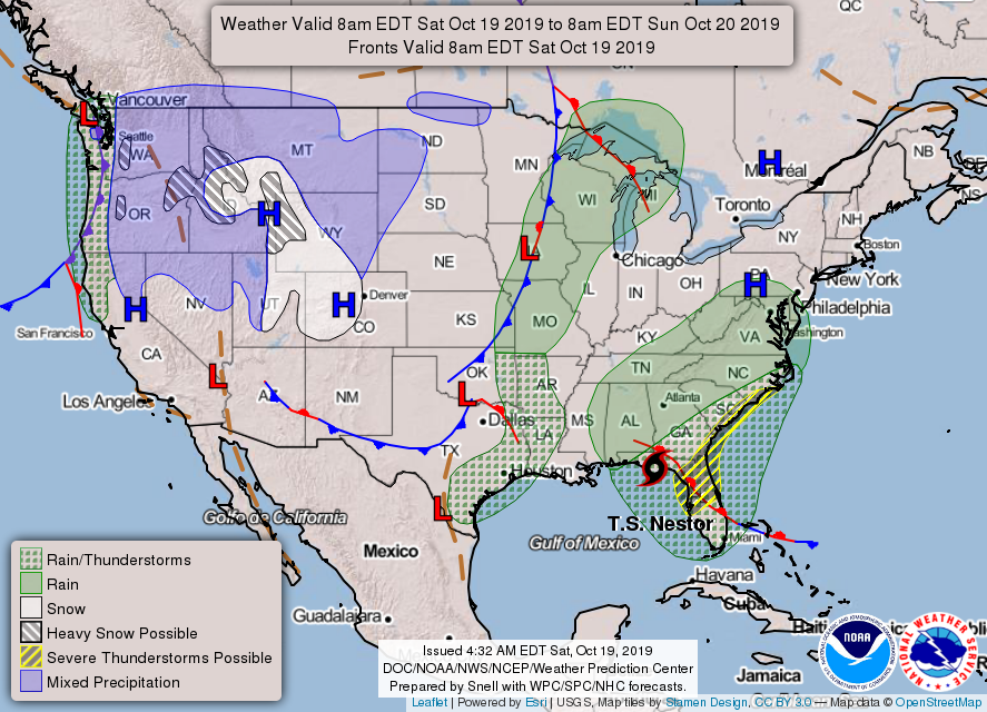
2- A front has pushed through during the overnight hours with a windshift and cooler temps. Instead of gusty winds out of the south, we’ll have them out of the north. This means those miniature tumbly weeds will blow back into the area today.
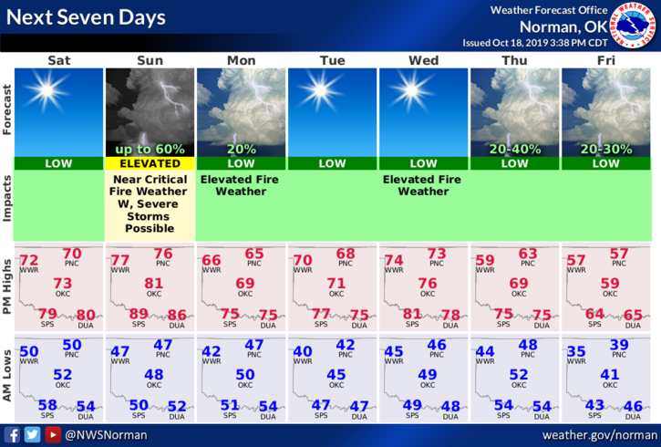
3-Here is your forecast from the NWS/NORMAN;
Today- Mostly sunny with highs in the lower 70s. North winds 10 to 15 mph with higher gusts.
Tonight- Clear with lows in the upper 40s. Winds will be light and variable.
HAVE A GOOD DAY!!
MIKE