0400L-FRIDAY UPDATE FROM ENID/GARFIELD COUNTY EMERGENCY MANAGEMENT-10/5/18
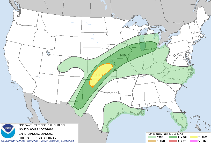
1- We are in a MARGINAL RISK for severe weather later this evening. The cold front that came in yesterday will lift back north as a warm front bringing us mid 80’s for highs today. A stronger cold front up north will converge with this warm front and push all this mess back into the region.
2-Forecast models are not in total agreement, per guidance, but with a warm front, a cold front, lots of tropical moisture, and of course, instability, IT’S GONNA STORM!!
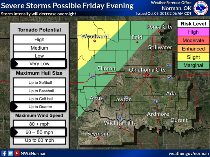
3- There is a Slight Risk out west and northwest so we’ll see where the heavier weather actually occurs. As with all possibilities for severe weather, we can expect strong winds and hail. The tornado threat is very low but is never out of the question. Spotters will be available if needed.
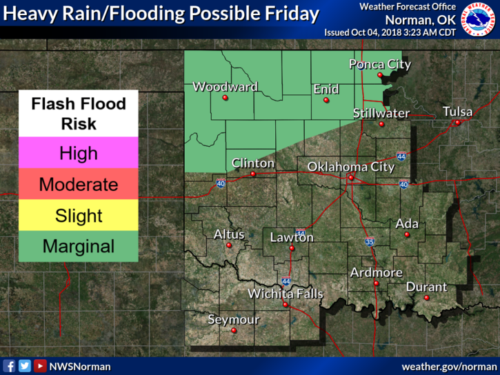
4- All this said, if storms train over the same areas, flooding could occur. Extreme caution is advised if you live in a low lying area prone to flooding. This system is a very slow mover, thus the training/flooding threat.
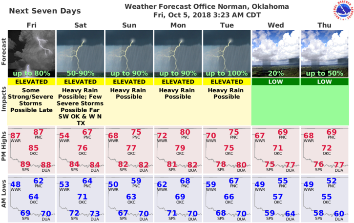
5- Overall, we’ll be ok. Just be prepared for heavy weather. Get our GARFIELD COUNTY EM app. You may need it this weekend. Here is your forecast from the NWS/NORMAN;
Friday-Patchy drizzle with a slight chance of showers before 8am. Cloudy through mid-morning then gradual clearing with a high near 87. East southeast winds 5 to 10 mph becoming south 15 to 20 mph in the afternoon. Winds could gust as high as 28 mph.
Friday Night-Showers likely and possibly a thunderstorm after 1am. Increasing clouds, with a low around 61. South wind 10 to 20 mph, with gusts as high as 25 mph. Chance of precipitation is 60%. New rainfall amounts between a tenth and quarter of an inch, except higher amounts possible in thunderstorms.
I will send an APP UPDATE later this morning. LIVE BROADCASTS DURING SEVERE WEATHER WILL ONLY BE BROADCAST ON THE Mike Honigsberg Sr Facebook page. The EM PAGE WILL BE SHUTDOWN IN A FEW MONTHS.
HAVE A GOOD DAY!
MIKE.