0420-L-THURSDAY UPDATE FROM ENID/GARFIELD COUNTY EMERGENCY MANAGEMENT-10/4/18
1-A cool front will affect the area during the day and then lift back north as a warm front tonight.
2- Showers are possible with a 50% chance then that goes down tonight as the front pushes back to the north.
3- Rain chances for our area, over the next 5 days, looks good so we could see 3-5 inches “over that timeframe” so we’ll see what happens for sure as this mess develops over the area.
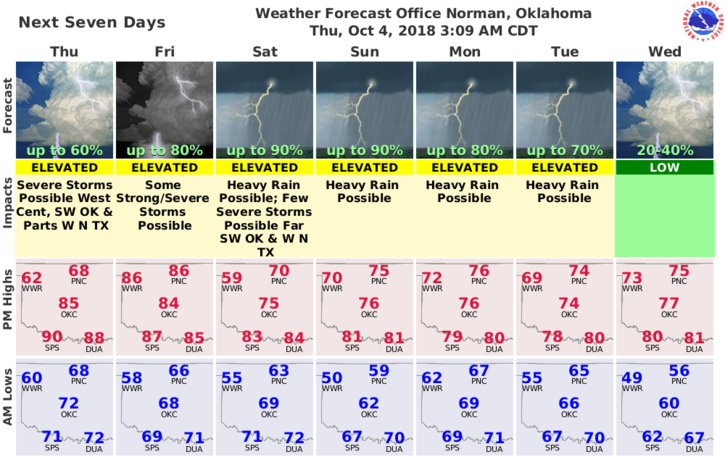
4- Here is your forecast from the NWS/NORMAN;
Today-Cloudy with a chance of thunderstorms. Cooler. Highs in the lower 70s. Northeast winds 10 to 15 mph. Chance of thunderstorms 50 percent.
Tonight-Mostly cloudy. A slight chance of thunderstorms in the evening, then a slight chance of showers after midnight. Lows in the lower 60s. Northwest winds around 10 mph in the evening becoming light and variable. Chance of precipitation 20 percent.
BE SURE AND GET OUR APP- GARFIELD COUNTY EM– YOUR NOT PREPARED WITHOUT IT.
One more thing to consider, if we do get a lot of rainfall, stay aware of flooding that could occur in low lying areas.
HAVE A GOOD DAY!!
MIKE