FROM GARFIELD COUNTY EMERGENCY MANAGEMENT-THURSDAY-10/5/17
DOWNLOAD OUR EMERGENCY APP-GARFIELD COUNTY EM– IT JUST MIGHT SAVE YOUR LIFE!
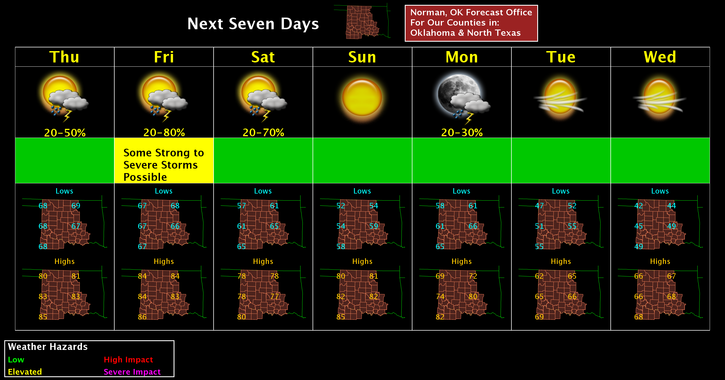
Warm and muggy with a chance for thunderstorms. No severe storms are expected today or tonight.
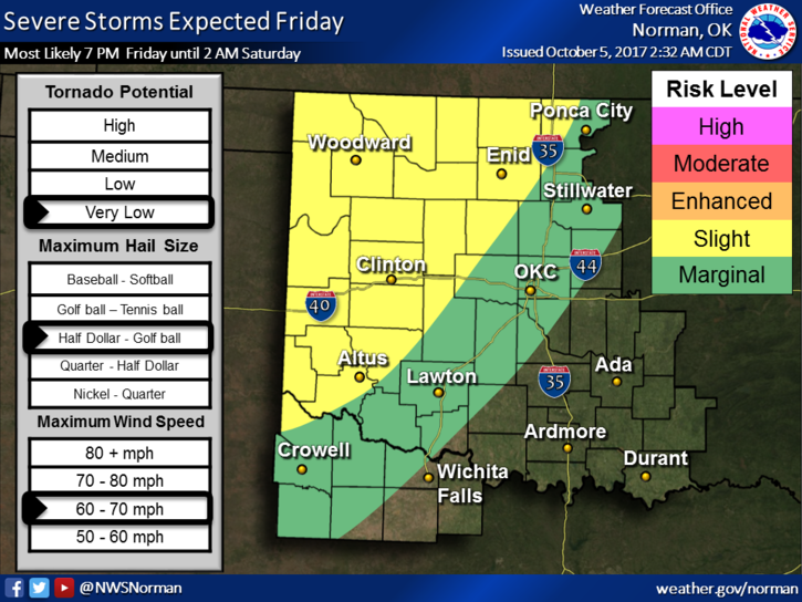
That said, there is a SLIGHT RISK for SEVERE WX FRIDAY AFTERNOON AND EVENING. School officials need to pay close attention to the lightning threat as storms will be in the area. Remember, IF YOU CAN HEAR THUNDER, YOU CAN BE HIT BY LIGHTNING. Besides lightning, winds may be a factor as storms move through the area. More on this as the forecast verifies for tomorrow.
Here is your forecast from the NWS/NORMAN;
Thursday-50 percent chance of showers and thunderstorms. Mostly cloudy, with a high near 80. South wind 8 to 13 mph. New rainfall amounts of less than a tenth of an inch, except higher amounts possible in thunderstorms.
Thursday Night-20 percent chance of showers and thunderstorms. Mostly cloudy, with a low around 69. South wind around 10 mph.
HAVE A SUPER DAY!!
MIKE