0250L- FRIDAY OUTLOOK FROM GARFIELD COUNTY EMERGENCY MANAGEMENT-9/15/23
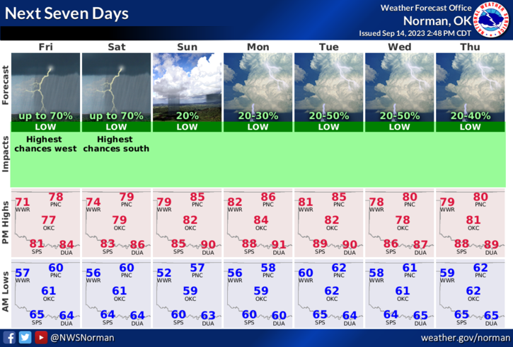
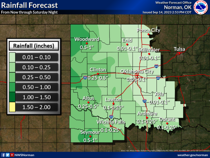
*The roller coaster of temperatures begin along with rain chances now into the fall. During a weather briefing yesterday, it appears our chance of getting back into the 90s is just about zero. On average, we’ll see upper 70s to mid-80s off and on over the next several weeks. As per rainfall here in the area, it appears one to two tenths of an inch are possible and that is reaching between now and Monday. Our best chance after that, per guidance, will be Tuesday into Wednesday. By the way, I derived my information from the NWS WFO’S of Norman and Wichita. I was asked about this yesterday so I figured I would pass this on.
* Overall, we’ll be ok. Here is your forecast from the NWS/NORMAN;
Today- Mostly cloudy this morning, then becoming partly sunny. Scattered showers. Scattered thunderstorms, mainly this morning. Highs in the mid-70s. Southeast winds around 5 mph. Chance of rain 50 percent.
Tonight- Mostly cloudy with scattered showers. Isolated thunderstorms in the evening, then scattered thunderstorms after midnight. Lows around 60. Northeast winds around 5 mph. Chance of rain 50 percent.
FINALLY- Be thinking about how prepared you might be or not. WHAT IF we lose power, lose internet, become restricted to home. How long can you get by without going to the grocery store, to the pharmacy, etc. I know these are extreme but WHAT IF?
HAVE A GOOD DAY!