0445L-SATURDAY OUTLOOK AND INFO FROM GARFIELD COUNTY EMERGENCY MANAGEMENT-9/21/19
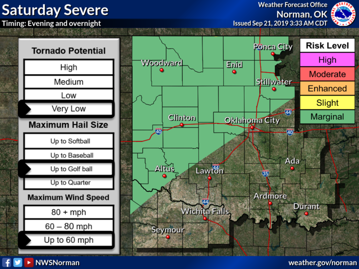
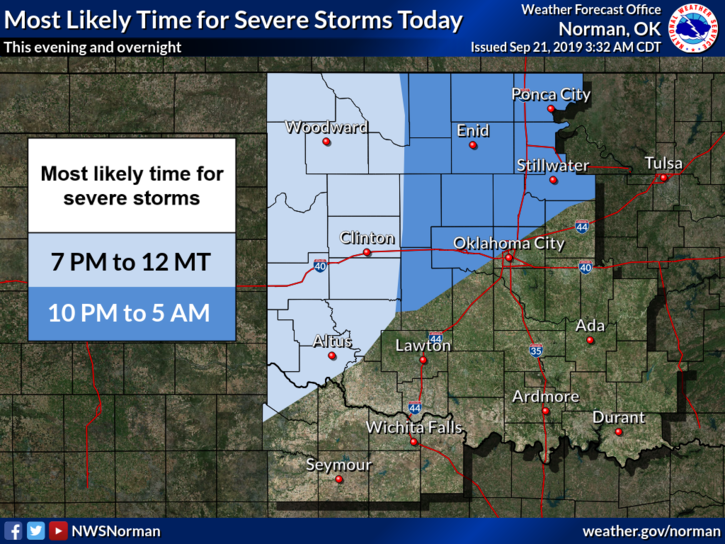
1- MARGINAL RISK for severe weather later tonight. This could get upgraded if a few things change so stay weather aware later today. IF YOU PLAN TO TRAVEL, especially north, check out the latest info from the NWS office nearest your destination. This link will take you to our website https://gcem.org/links/ and those NWS OFFICES.
2- If we do see storms today, torrential rainfall, strong winds, and hail will be the main threats. See graphics attached.
3- Overall, we’ll be ok so we’ll keep an eye out and advise as needed. Make sure you download our GARFIELD COUNTY EM app. It’s free and It just might save your life!!
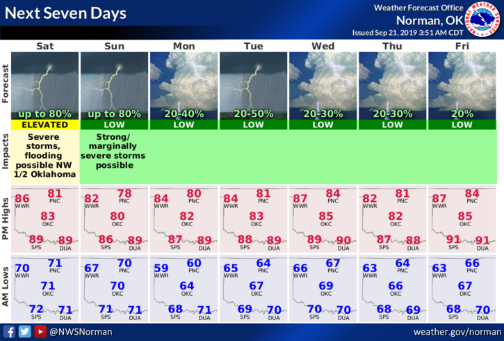
4-Here is your forecast from the NWS/NORMAN;
Saturday-40% chance for thunderstorms. Cloudy with a high near 85. South winds 10 to 20 mph with gusts to 25 mph.
Saturday Night-Showers and thunderstorms likely after 1am. Mostly cloudy with a low around 69. South winds 10 to 15 mph gusting to 21 mph. Chance of precipitation is 60%. New rainfall amounts of less than a tenth of an inch, except higher amounts possible in thunderstorms.
Have a great day!!
MIKE