0330L-MONDAY OUTLOOK FROM GARFIELD COUNTY EMERGENCY MANAGEMENT-7/25/22
GARFIELD COUNTY EM is our notification app. It’s free and remember- you’re not PREPARED without it!
1- The Garfield County Task Force arrived back in the county last night around 9pm.
2- “EXCESSIVE HEAT WARNING” IN EFFECT FROM 12 NOON TODAY UNTIL 8PM THIS EVENING. The heat index could reach 110 today. A HEAT ADVISORY is in effect for Tuesday.
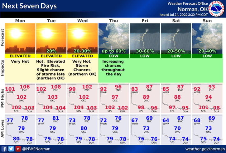
3-Continue to take those heat precautions and it appears we will see a break in these temps around Thursday after a front pushes through the area. Look at the planner graphic for highs and lows. If these temps and rain occur, we will still be a little humid but not burnt toast!
4- Here is your forecast from the NWS/NORMAN;
Today-Mostly sunny. Hot with highs around 106. South winds 10 to 15 mph.
Tonight-Mostly cloudy in the evening, then becoming partly cloudy. Lows around 80. South winds 10 to 15 mph with gusts up to 25 mph. Heat index values up to 106 early in the evening.
STAY COOL AS BEST YOU CAN AND HAVE A GOOD DAY!