0400L-MONDAY OUTLOOK FROM GARFIELD COUNTY EMERGENCY MANAGEMENT 04/01/24
*Today would be a good time to download our GARFIELD COUNTY EM app. You’ll receive advisories and warnings “directly” from the NWS, in detail. You’ll also receive information from us in Emergency Management.
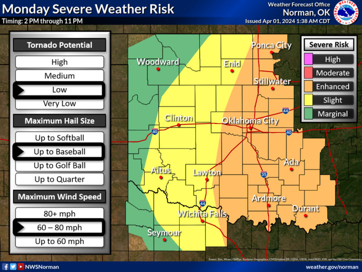
*We are in a Slight & Enhanced risk for severe storms today. Where the dryline actually sets up will depend on our level of severe weather, if at all. If storms were to form west of us and mature quickly, large hail and winds to 70 mph would be our main threats. The tornado threat for us is very low but east of I-35, that threat goes up.
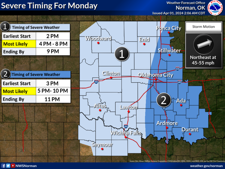
* Just be prepared for possibly some severe weather this afternoon and this evening. Again, we’ll have to wait and see where things line up. I have a briefing with NWS folks at 10am and will post an update after that.
*Overall, we’ll be ok so here is your forecast from the NWS/NORMAN;
Today- Mostly cloudy with a slight chance of thunderstorms. A slight chance of showers this morning, then a chance of showers this afternoon. Highs in the upper 70s. South winds 10 to 15 mph with gusts up to 25 mph. Chance of rain 40 percent.
Tonight- Mostly cloudy with a chance of thunderstorms. Showers likely, mainly in the evening. Much cooler. Less humid with lows around 40. Northwest winds 15 to 20 mph with gusts up to 30 mph. Chance of rain 70 percent.
THERE WILL BE NO STORM SIREN TEST TODAY.
I’LL UPDATE LATER THIS MORNING. HAVE A GOOD DAY!