0400L-MONDAY OUTLOOK FROM GARFIELD COUNTY EMERGENCY MGMT-4/13/2020
1- FREEZE WARNING IN EFFECT UNTIL 10 AM THIS MORNING.
2- A rain/snow mix is expected tonight as another system moves through the area. If this precip occurs per guidance, rain could begin as early as 7pm this evening with a transition to snow around 10-11pm. Surface temps are still warm so any accumulations should only be on grassy surfaces. We are expecting a half inch “if” it snows. We’ll see what happens.
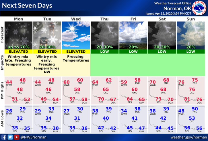
3-Here is your forecast from the NWS/NORMAN;
Today-Increasing clouds and much cooler. Highs in the mid-40s with north winds 10 to 15 mph.
Tonight-Cloudy. A slight chance of rain and snow in the evening through the overnight hours. Lows in the lower 30s. East winds around 10 mph in the evening becoming light and variable. Chance of precipitation 50 percent.
HAVE A GOOD DAY!
MIKE