0405L-SUNDAY OUTLOOK & INFO FROM GARFIELD COUNTY EMERGENCY MGMT-4/12/2020
*WIND ADVISORY IN EFFECT FROM 1PM UNTIL 10 PM TONIGHT*
*FREEZE WARNING IN EFFECT FROM 10PM TONIGHT UNTIL 10 AM MONDAY MORNING*
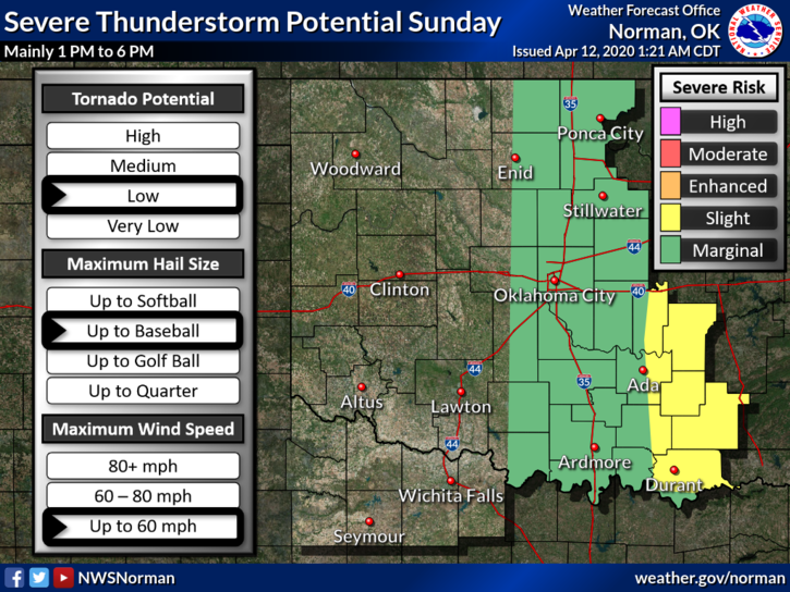
1- We are in a MARGINAL RISK for severe weather from roughly 1-6 pm today. A cold front is heading our way and with moisture in place along with instability in the atmosphere, IF WE SEE ANY STORMS, they could be a bit tough for a while. We’ll see how this mess comes together.
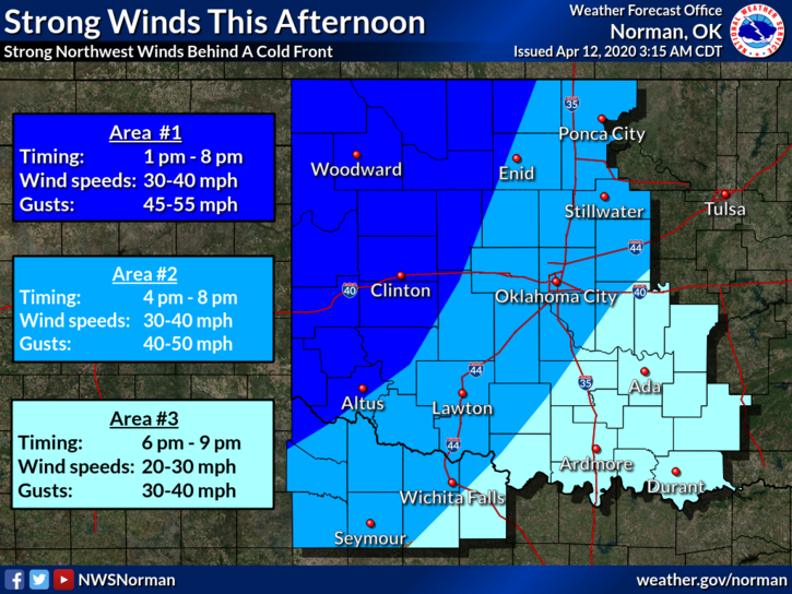
2- OUR BIGGEST THREAT WILL BE THE WIND. We are expecting winds to average 30-40 mph with gusts upwards of 50-55 mph so hopefully we don’t get that high but either way, winds will be dangerous. If you are out driving and you are in crosswinds, be prepared for strong gusts. NO CONTROLLED BURNING TODAY!! The winds will cause our FIRE DANGER TO INCREASE DRAMATICALLY so if you see smoke or fire call 911 immediately.
3- Here is your forecast from the NWS/NORMAN;
Today-Mostly cloudy. A slight chance of thunderstorms from early in the morning until early afternoon. Windy. Some thunderstorms may be severe early in the afternoon. Highs in the lower 70s. Temperatures falling into the upper 40s in the afternoon. South winds around 15 mph increasing to northwest 25 to 35 mph with gusts to around 50 mph in the afternoon. Chance of thunderstorms 50 percent.
Tonight-Mostly clear. Windy. Much colder. Lows in the upper 20s. North winds 20 to 30 mph with gusts to around 45 mph decreasing to 10 to 20 mph after midnight.
DIRECTORS COMMENT- SECURE ITEMS AROUND THE HOUSE AND BE PREPARED FOR STRONG WINDS.
HAVE A GREAT DAY!!
MIKE