0335L-MONDAY OUTLOOK FROM GARFIELD COUNTY EMERGENCY MANAGEMENT 04/15/24
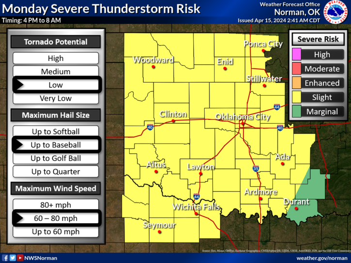
*We have been lowered into a Slight risk for severe weather from an Enhanced risk which was pushed north into Kansas. We still have a good chance for severe weather in Oklahoma and it appears it will be overnight tonight. We have a storm system out west, a frontal boundary that will push through early Tuesday morning, pretty good moisture return, and a dryline that is already showing up in the OK/TX panhandles. Per guidance, models are not handling the information very well and the severity of what was discussed yesterday has lessened some. We won’t let our guard down quite yet.
*We have another briefing at 10 am this morning so I will wait to put out any additional details and I will send it out over our app and on social media. Information changes!
Here is your forecast from the NWS/NORMAN;
Monday-Mostly cloudy. A slight chance of showers and thunderstorms in the afternoon. Some thunderstorms may be severe. Breezy with highs in the lower 80s. South winds 15 to 25 mph. Gusts up to 40 mph in the afternoon. Chance of rain 20 percent.
Monday Night- Showers and thunderstorms. Some thunderstorms may be severe. Breezy with lows in the upper 50s. South winds 20 to 25 mph with gusts up to 40 mph. Chance of rain 90 percent.
HAVE A GOOD DAY!