0435L-MONDAY UPDATE FROM ENID/GARFIELD COUNTY EMERGENCY MANAGEMENT-4/16/18
1- FREEZE WARNING IN EFFECT UNTIL 9AM
2- Winds will become southerly and gradually increase during the afternoon.
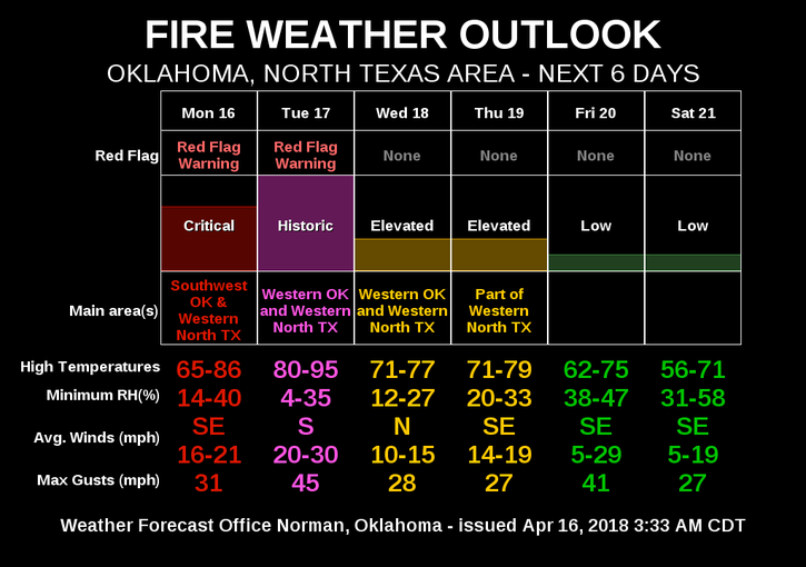
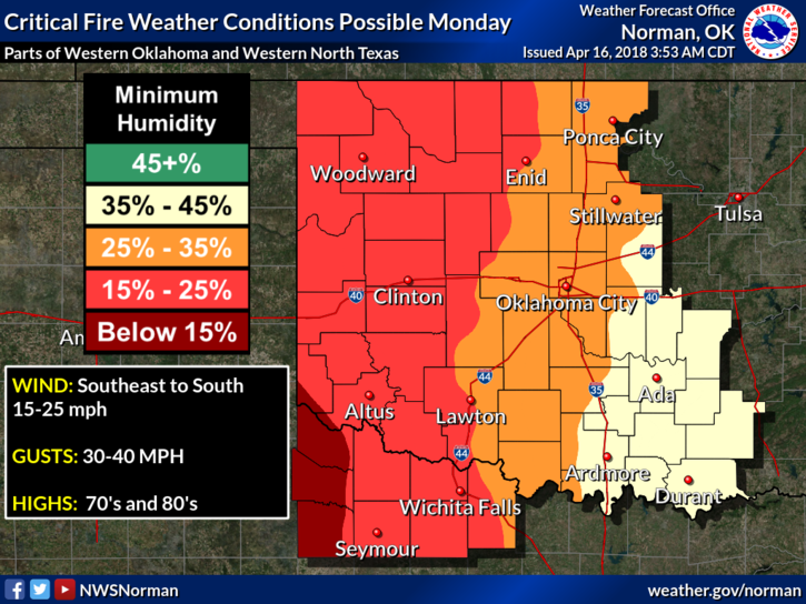
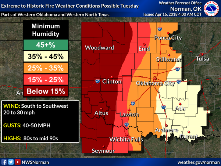
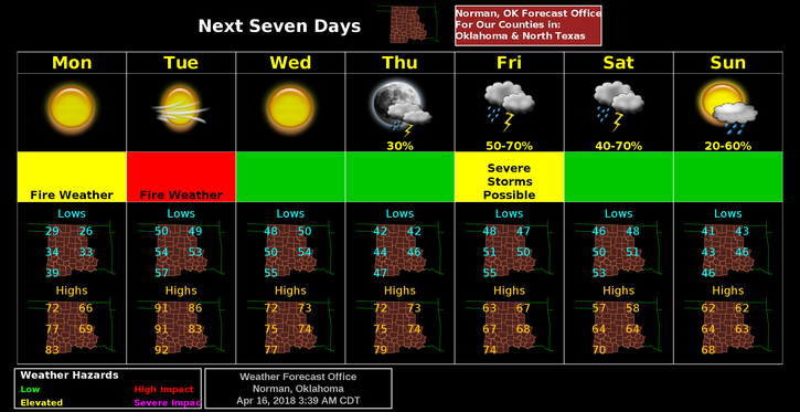
3- FIRE DANGER will continue this week. See graph
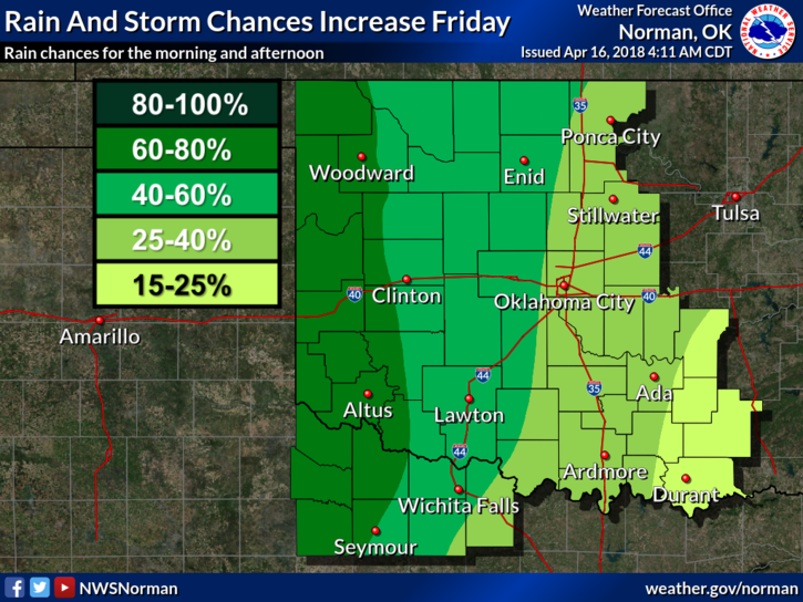
4- Believe it or not, SHOWERS AND THUNDERSTORMS are possible Friday and Saturday. We can only hope.
5-Overall, things look good right now; our Task Forces are home so we’ll see how the week develops.
6- Here is your forecast from the NWS/NORMAN ;
Monday-Sunny, with a high near 67. North northeast wind 6 to 14 mph becoming south southeast in the afternoon. Winds could gust as high as 20 mph.
Monday Night-Mostly clear, with a low around 49. Southeast wind 11 to 14 mph, with gusts as high as 20 mph.
HAVE A GREAT DAY and if you see SMOKE OR FIRE, CALL 911
MIKE