0425L-SUNDAY MORNING UPDATE FROM ENID/GARFIELD COUNTY EMERGENCYMANAGEMENT-4/15/18
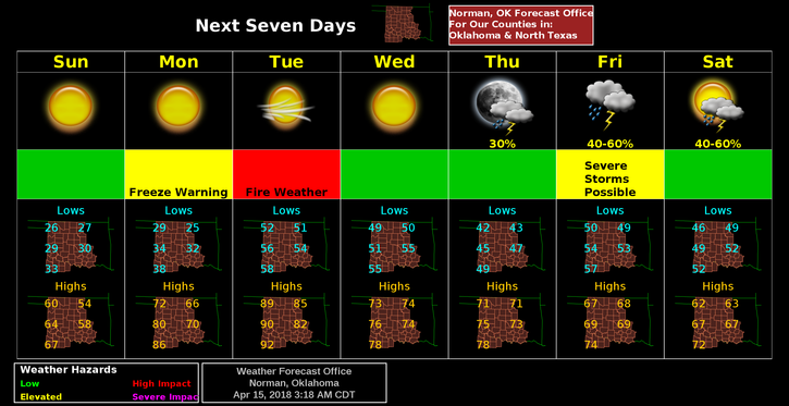
1-FREEZE WARNING IN EFFECT UNTIL 10AM TODAY.
2-FREEZE WARNING IN EFFECT FROM 1 AM UNTIL 9 AM MONDAY MORNING
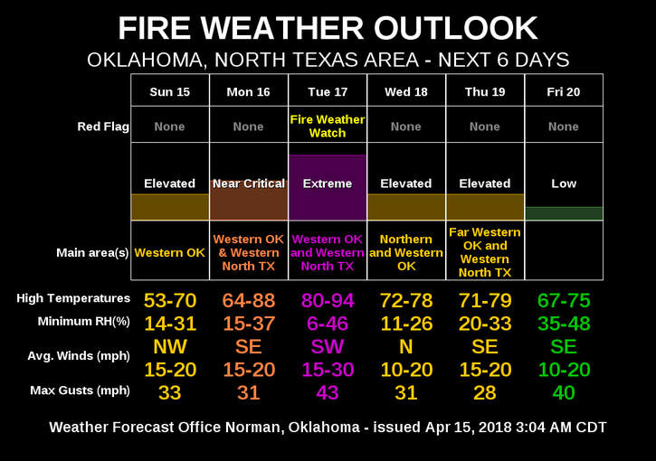
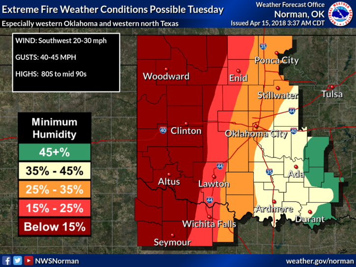
3- We are in a GRASSLAND FIRE WEATHER DANGER AREA TODAY per guidance. As long as we continue to have strong winds and low humidity, we are asking that everyone restrain from burning anything outside until further notice. These conditions are wearing on all of us now but stay visually aware and report any smoke or fire to 911. See graph for fire conditions attached.
4-We may have a chance for some severe weather by the end of the week but that is a long time out. Personally, I hope it happens as we need the wet stuff falling from the sky to help green things up and lessen the fire danger. We’d still have to be up but at least our Task Force would be home.
5-Task force #1 is in southern Dewey County and should return home this morning. A coordination meeting will be held again early this morning with task force coordinators and emergency management officials to determine our next move. I’ll update on this later this morning. Keep all the emergency service folks in thought and prayer.
6- Here is your forecast from the NWS/NORMAN;
Sunday-Sunny, with a high near 55. North northwest wind 17 to 22 mph, with gusts as high as 31 mph.
Sunday Night-Clear, with a low around 25. North northwest wind 8 to 13 mph becoming light northeast after midnight.
HAVE A SUPER DAY!!
MIKE