0415L-MONDAY OUTLOOK FROM GARFIELD COUNTY EMERGENCY MANAGEMENT-4/29/19
This would be a great time to make sure you are prepared for storms by downloading our GARFIELD COUNTY EM app. It appears we’ll be sending a lot of info this week starting later today. SEE BELOW. If condition warrant at noon, we will conduct a storm siren test in Enid.
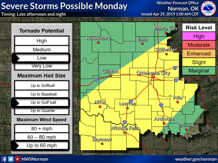
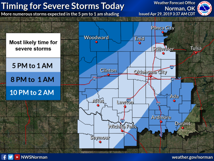
1- We are in a SLIGHT AND MARGINAL RISK for severe weather later today and tonight. Where storms form and track are an issue but it appears we have a good chance for some thunderstorm activity later today into the overnight hours. Depending where things fire up is dependent on what may occur in that respective area.
2- As of 0415L this morning, when storms form later today, and this will change some during the day, expect hail, damaging winds, and there is a low tornado threat BUT THIS APPEARS TO BE SOUTH of us. We’ll be monitoring this all day so updates will be sent accordingly.
3- Until storms do form, don’t change your plans yet but do stay weather aware. It would be a good idea to stay aware at least through Wednesday. Make sure to listen to our LOCAL RADIO STATIONS.
4- Here is your forecast from the NWS/NORMAN;
Monday-Mostly cloudy. A slight chance of thunderstorms in the morning, then a chance of thunderstorms in the afternoon. Cooler. Highs in the upper 60s. North winds 10 to 20 mph. Chance of thunderstorms 30 percent.
Monday Night-Showers and thunderstorms likely in the evening, then showers and thunderstorms after midnight. Locally heavy rainfall possible. Lows in the mid 50s. Northeast winds around 10 mph. Chance of precipitation 80 percent.
I’ll advise as needed.
MIKE