0325L-TUESDAY OUTLOOK FROM GARFIELD COUNTY EMERGENCY MANAGEMENT-4/30/19
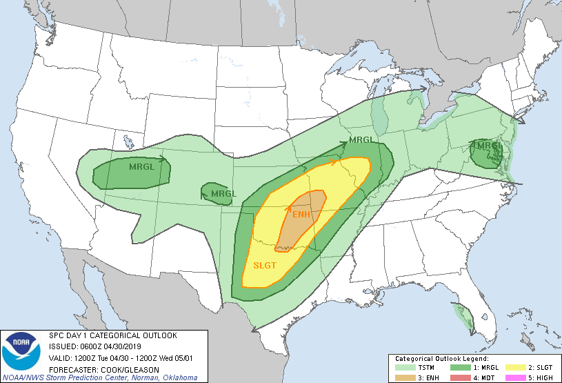
1-WE ARE IN A SLIGHT RISK FOR SEVERE WEATHER TODAY. AN ENHANCED RISK IS EAST OF US. SEE THE ATTACHED GRAPHICS AND DON’T PANIC AS THEY WILL CHANGE SOME DURING THE DAY.
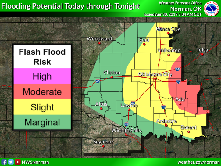
2-WE ARE ALSO IN A FLOOD WATCH THROUGH TUESDAY NIGHT. USE EXTREME CAUTION WHILE DRIVING ESPECIALLY IN LOW-LYING AREAS. We have a “potential” of 1.5 to 3 inches of rainfall through today. As of 0300 local time this morning we have received approximately ½ to ¾ of rainfall.
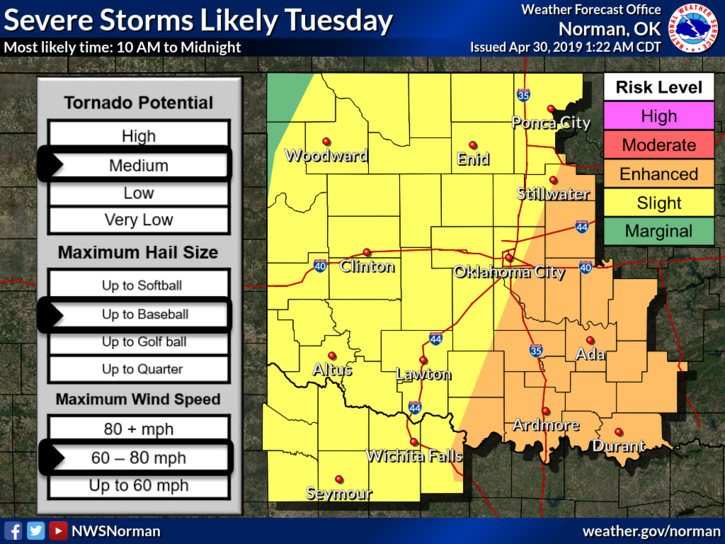
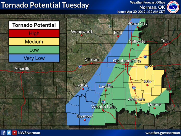
3- As always during severe weather events, we may see very strong winds, possibly large hail, torrential rainfall, and keep an eye out for the tornado possibility. Overall, we’ll be ok but just stay weather aware today. I have a briefing at 10 am this morning and will advise you on social media and over our GARFIELD COUNTY EM app. SPOTTERS WILL BE PUT ON “STANDBY” LATER THIS MORNING.
4- If you plan to travel east or southeast, it may get interesting later this afternoon as it appears right now. Be very careful and pay attention to your surroundings.
5- Here is your forecast from the NWS/NORMAN;
Tuesday- Showers and thunderstorms. Some of the storms could be severe and produce heavy rainfall. High near 70. East wind 5 to 10 mph becoming south in the afternoon. Chance of precipitation is 80%. New rainfall amounts between 1 and 2 inches possible.
Tuesday Night-40 percent chance of showers and thunderstorms. Some of the storms could be severe. Mostly cloudy, with a low around 56. South wind 5 to 10 mph becoming north northeast after midnight.
I’ll advise again later this morning.
MIKE