0330L-MONDAY OUTLOOK FROM GARFIELD COUNTY EMERGENCY MANAGEMENT-8/10/2020
GARFIELD COUNTY EM is our emergency app. Don’t get caught without it!
1- We are in a MARGINAL RISK for severe weather later today. Ongoing convection in Kansas shouldn’t affect us this morning. This evening may be another story. If storms occur, winds and hail will be the main threats.
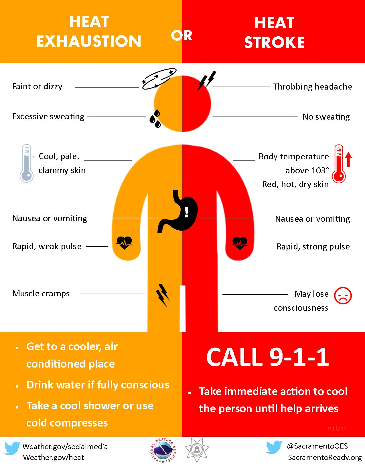
2- Hot temps will also be a threat to those with heat issues once again today so be careful out there. Also, strong southerly winds may affect driving on east/west roads so drive with caution.
3-Overall, we’ll be ok so with that, here is your forecast from the NWS/NORMAN;
Monday-20 percent chance of showers and thunderstorms after 1pm. Mostly sunny with a high near 96. Heat index values as high as 99. South winds 10 to 20 mph gusting to 25 mph.
Monday Night-40 percent chance of showers and thunderstorms. Mostly cloudy with a low around 71. South southeast wind 5 to 10 mph.
HAVE A GOOD DAY!
MIKE