0335L-MONDAY OUTLOOK FROM GARFIELD COUNTY EMERGENCY MANAGEMENT-8/14/23
*Download our GARFIELD COUNTY EM app and click on the GCEM Blog icon. You will find my daily posts there. The information there is also located on the front page of our website at https://gcem.org
The lightning/thunder activity last night was impressive. It had been awhile since it sounded like bowling in the clouds. We received around ½ inch of rainfall here on the west side of Enid so let me know your totals. Also, if anyone sustained any wind damage last night, be sure to send pics and that report to me via the app or email. Be sure to include your name, address, phone number. The only report for winds last night was from Kremlin Fire at an estimated 70 mph, possibly higher. The Marshall Mesonet station south of Douglas in northern Logan County had an 89 mph gust.
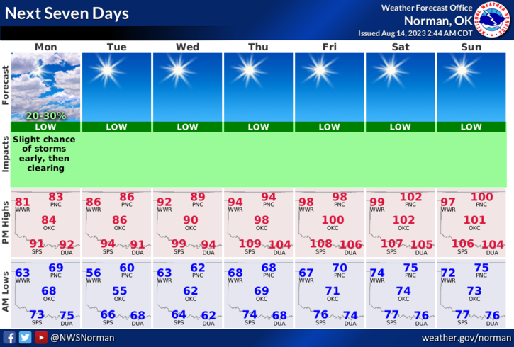
Today through Tuesday, we’ll enjoy cooler temps and then the heater gets turned back on. We’ll be back in the upper 90s to low 100’s. Enjoy the cooler temps while you can.
Overall, we’ll be ok so here is your forecast from the NWS/NORMAN;
Today- Partly sunny this morning, then clearing. Highs in the mid-80s. North winds 10 to 15 mph with gusts up to 25 mph.
Tonight- Clear. Lows in the upper 50s. North winds 10 to 15 mph, diminishing to around 5 mph after midnight.
HAVE A GOOD DAY!