0320L- SUNDAY OUTLOOK FROM GARFIELD COUNTY EMERGENCY MANAGEMENT-8/13/23
*Download our GARFIELD COUNTY EM app and click on the GCEM Blog icon. You will find my daily posts there. The information there is also located on the front page of our website at https://gcem.org
*We have a HEAT ADVISORY in effect from 1pm until 9pm tonight. Heat Index values may reach 105 by later this afternoon.
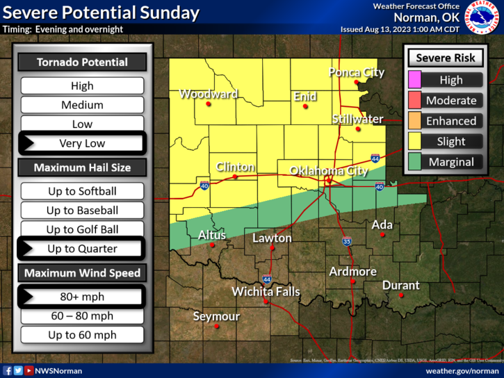
* SLIGHT RISK for severe weather later today into tonight. The tornado risk is very low but we can expect quarter size hail and winds in excess of 80+ mph winds.
* Fire Danger for us, is slowly climbing out there. Be sure to call in any controlled burns to dispatch at 580-234-FIRE (3473).
*Overall, we’ll be ok. Here is your forecast from the NWS/NORMAN;
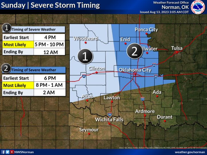
Today-Mostly sunny with a chance of showers. Isolated thunderstorms this morning, then a chance of thunderstorms this afternoon. Some thunderstorms may be severe with damaging winds and large hail this afternoon. Highs in the mid-90s. East winds 5 to 10 mph, becoming southwest this afternoon. Chance of rain 50 percent.
Tonight-Thunderstorms likely. Showers likely. Some thunderstorms may be severe with damaging winds and large hail. Humid with lows in the upper 60s. Northwest winds 10 to 15 mph with gusts up to 25 mph. Chance of rain 70 percent.
HAVE A GOOD DAY!