0325L- MONDAY OUTLOOK FROM GARFIELD COUNTY EMERGENCY MANAGEMENT-8/28/23
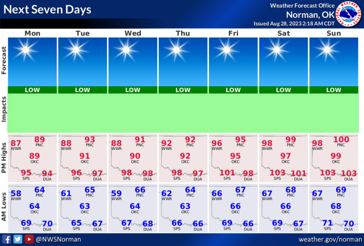
* Warm temps expected again today as that upper ridge continues to retrograde to the west. We will see temps gradually climb this week but being under northerly flow will help keep temps lower and allow drier air to stay in place. I WON’T COMPLAIN ABOUT THIS. Tonight’s low temps could drop into the upper 50s at least in NW Oklahoma. Ours should be in the low to mid 60s.We’ll see what happens.
*As stated before, the fire danger is climbing so use extreme caution if doing any type of burning out there. Overall, we’ll be ok so here is your forecast from the NWS/NORMAN;
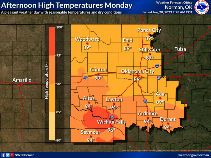
Today- Sunny. Highs in the upper 80s. Northeast winds 5 to 10 mph.
Tonight- Mostly clear. Lows in the mid-60s. Northeast winds 5 to 10 mph.
SEPTEMBER IS PREPAREDNESS MONTH. Expect me to drive you crazy with things you should be doing and things you should have already done! This will start this Friday.
*This post can be found under GCEM Blog on the GARFIELD COUNTY EM app. It can also be found on the front page of our website at https://gcem.org
HAVE A GOOD DAY!