FROM GARFIELD COUNTY EMERGENCY MANAGEMENT
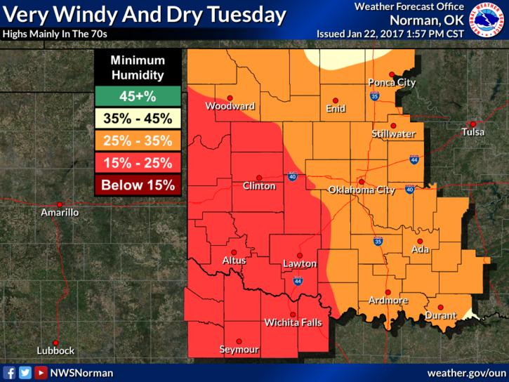
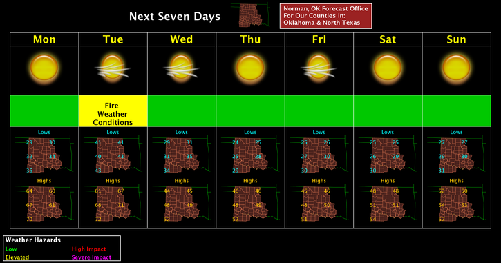
Let the winds blow, will be the theme for this week. Tuesday looks to be the really windy day, 15-25 with higher gusts, so for the most part, winds will average 5-15 mph the rest of the week. Along with the winds, the FIRE DANGER will be going up too. Tuesday looks to be the most critical day so be extremely careful using anything related to fire.
Rainfall looks bleak this week so what we received over the weekend will be it for a while as it looks right now. Always remember that conditions can change.
As stated last week, I am almost done with a short story on POWER OUTAGES=FRUSTRATION and how this relates to your LEVEL OF PREPAREDNESS. Some folks and possibly some media won’t like this, but I will be speaking the truth. I hope to have this out this WEDNESDAY.
One thing working for us right now if you are a sun lover is that we should see a lot of the sun this week. Hope so. I hate cloudy days.
This said, here is your forecast from the NWS/NORMAN;
Monday-Sunny, with a high near 59. Light south wind increasing to 12 to 17 mph in the morning. Winds could gust as high as 24 mph.
Monday Night-Mostly clear, with a low around 41. South southeast wind around 14 mph, with gusts as high as 20 mph.
HAVE A GREAT DAY!!
MIKE