0430L-MONDAY MORNING UPDATE FROM ENID/GARFIELD COUNTY EMERGENCY MANAGEMENT-7/16/18
1- STORM SIREN TEST TODAY AT NOON, WEATHER PERMITTING. IF YOU LIVE NEAR ONE AND CAN LET US KNOW THAT IT’S WORKING OK, PLEASE EMAIL US AT mhonigsberg@enid.org OR mike@gcem.org REMEMBER THAT STORM SIRENS ARE “OUTDOOR WARNING DEVICES”. This will be a SHORT TEST. DO “NOT” CALL 911
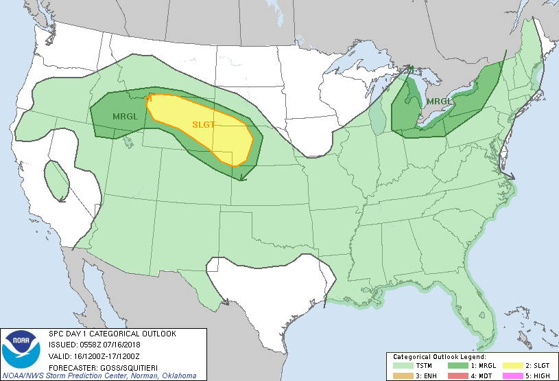
2- A frontal boundary will be CREEPING into the area today possibly causing enhanced thunderstorm activity. If this occurs, strong winds, torrential rainfall, and possibly some hail will be the main threats. We are in a GENERAL thunderstorm risk area today so just keep this in mind. There are several boundaries around the area and it won’t take much to get thunderstorms going. We don’t expect any severe weather BUT It’s not out of the question.
3- The HEAT will continue to be a factor so take the necessary precautions to protect yourselves and your pets. We are not in a HEAT ADVISORY here but it will be close as humidity will play an important role in higher temps today and tomorrow. After this front actually pushes through we will become a lot hotter Wednesday through the weekend with high temps in the 100’s.
4- Here is your forecast from the NWS/NORMAN;
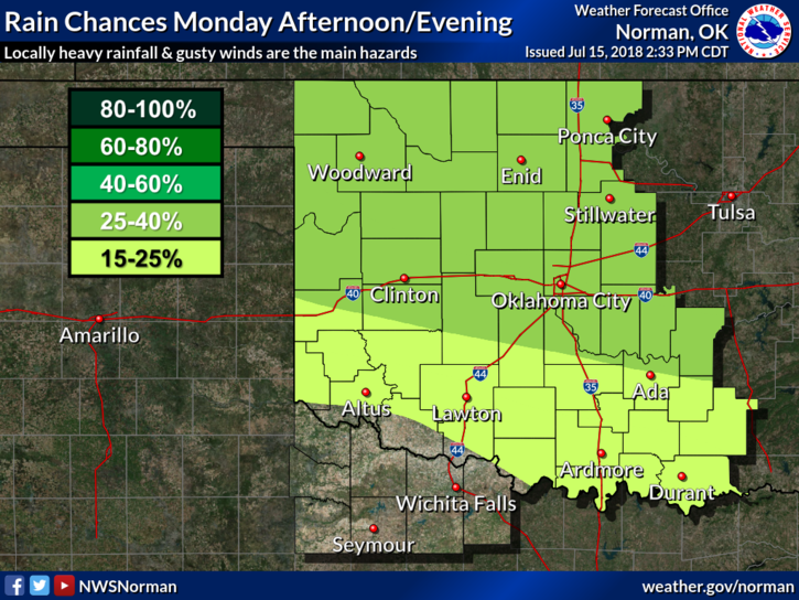
Monday-30 percent chance of showers and thunderstorms, mainly after 1pm. Partly sunny with a high around 95. Heat index values as high as 100. South southeast winds around 5 mph.
Monday Night-40 percent chance of showers and thunderstorms. Mostly cloudy with a low around 75. Southeast wind around 10 mph.
HAVE A SUPER DAY AND STAY COOL.
MIKE