0315L-MONDAY OUTLOOK FROM GARFIELD COUNTY EMERGENCY MANAGEMENT-7/26/21
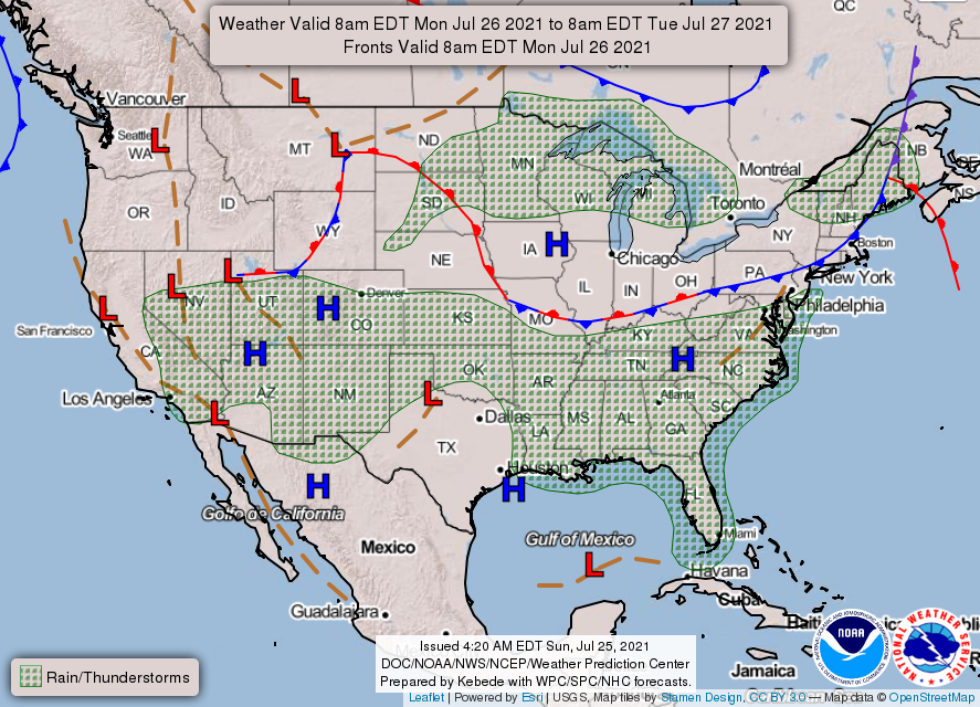
1- General Thunderstorm Risk today. More of the same can be expected like yesterday. Storms will form where they form and those areas will receive a lot of rainfall. Storm cells won’t be moving very fast so flash flooding may be a risk along with strong winds. These storms tend to be pulse storms in nature meaning they will build up quickly rain out and collapse. When they collapse, they will produce moderate to high winds.
2- If you utilize radar, watch for outflow boundaries as they tend to be mini-fronts and as they merge, convection can occur and you have new storms. Yesterday’s storms weren’t expected to be severe but winds caused a lot of the severe issues and we’ll see this again today. Overall, we’ll be ok but keep an eye to the sky!!
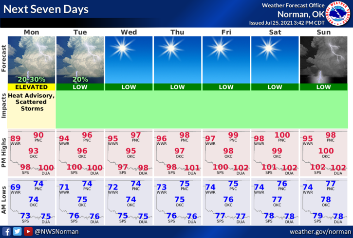
3- Here is your forecast from the NWS/NORMAN;
Monday-Partly cloudy with a chance of thunderstorms. Highs in the lower 90s. East winds around 10 mph. Heat index values around 99. Chance of thunderstorms 30 percent.
Monday Night- A slight chance of thunderstorms in the evening. Lows in the lower 70s. East winds around 10 mph in the evening becoming light and variable. Chance of thunderstorms 20 percent.
4- Be sure to download our GARFIELD COUNTY EM app. You may need it sooner than later!
MIKE