0330L-SUNDAY OUTLOOK FROM ENID/GARFIELD COUNTY EMERGENCY MANAGEMENT-7/25/21
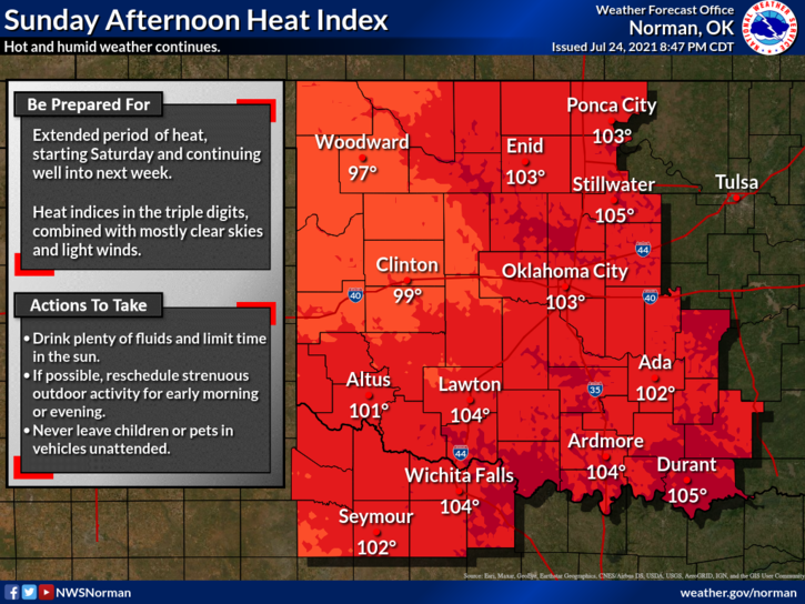
1- HEAT ADVISORY IN EFFECT FROM NOON UNTIL 7PM THIS EVENING
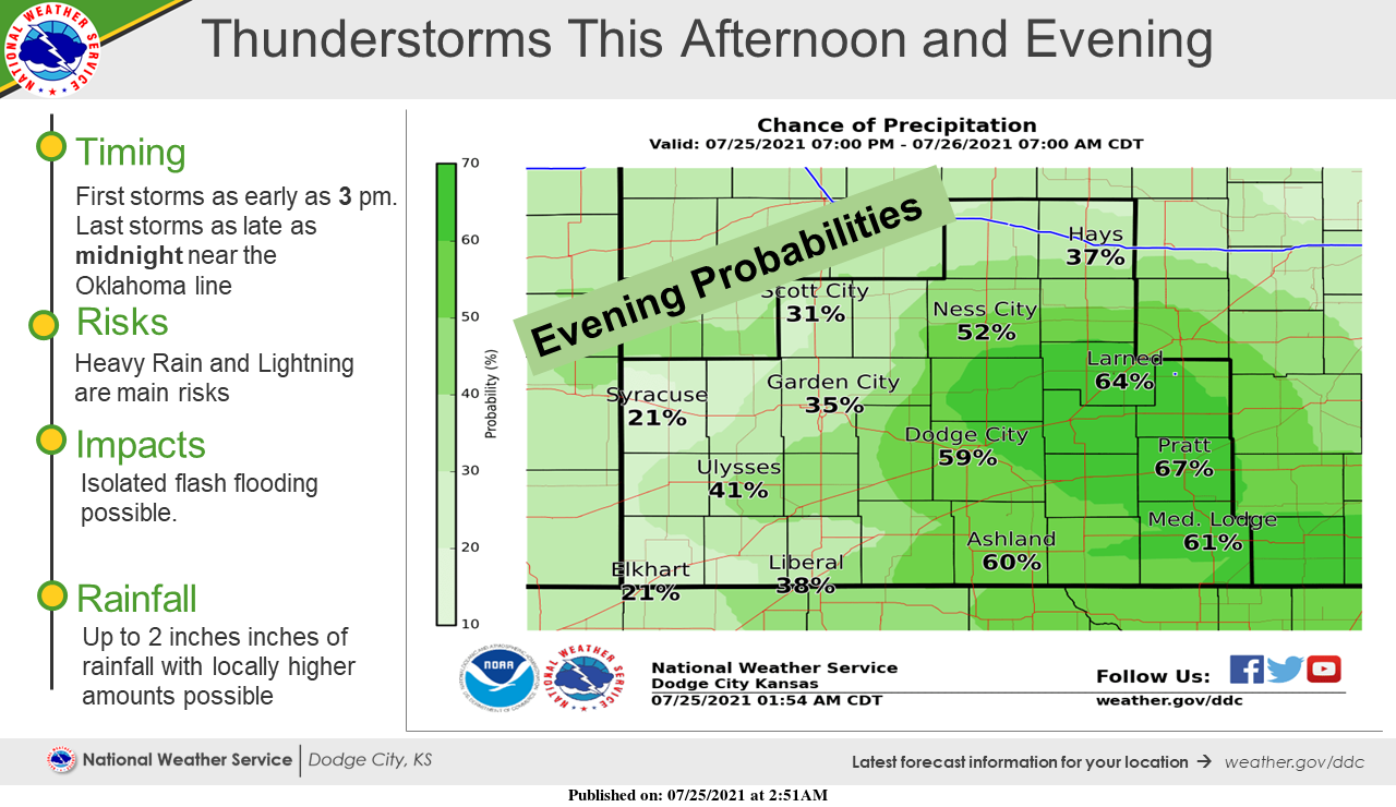
2- Warm air advection will continue to bring moisture into the region today and we can expect scattered isolated showers and possibly thunderstorms around the northern half of the state. A front is pushing towards us causing some instability and thus the thunderstorm chances. This will continue through part of Monday then high pressure moves in and actually takes hold.
3- If storms should occur, expect torrential rainfall, lightning, and the possibility of downburst winds. These storms will be pulse type in nature and won’t move very fast as winds aloft are very weak. In which direction storms will move is questionable too. We’ll see what happens. Here is your forecast from the NWS/NORMAN;
Today-Partly cloudy with a 20% chance of thunderstorms in the morning. Highs in the upper 90s. Southeast winds around 10 mph.
Tonight-Mostly cloudy with a 50% chance of thunderstorms. Lows in the lower 70s. East winds around 10 mph.
HAVE A GOOD DAY and make sure you download our GARFIELD COUNTY EM app.
MIKE