0325L-TUESDAY OUTLOOK FROM GARFIELD COUNTY EMERGENCY MANAGEMENT-7/27/21
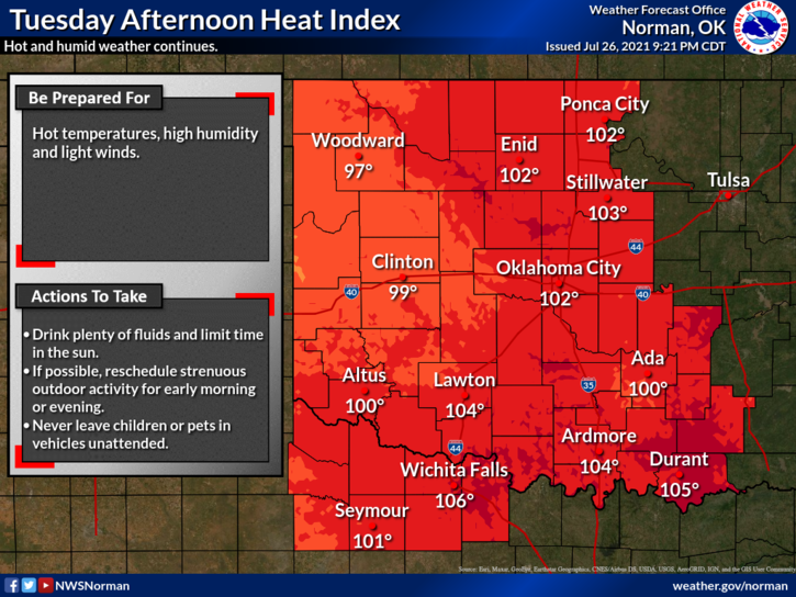
1-HOT AND HUMID once again so if you work outside, pace yourselves, stay hydrated, and be careful. We are still in that General Thunderstorm risk area but it’s less likely later today. We will be warming up as we get on into the week so just pay attention to how you feel and if you have kids, pay close attention to them also. Heat stresses animals too. Make sure they have shade, fresh water several times a day, and food. It doesn’t take long for any living thing to become stressed in the heat.
2- If any storms occur, rainfall will be abundant. Yes, we are VERY humid and “precipitable water values” are high. This means we can have rainfall rates very high per hour depending on that rate. It varies so when the NWS makes a statement that Pwats are 1.5 to 2 inches per hour, get ready for torrential rainfall. I think we all have seen this several times this summer.
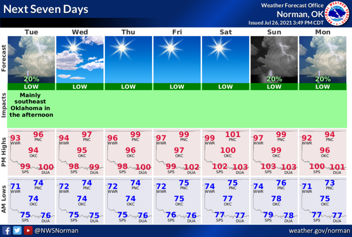
3- All this said, we’ll be ok so here is your forecast from the NWS/NORMAN;
Tuesday-Mostly sunny. Highs in the upper 90s. Light and variable winds becoming southeast around 10 mph in the afternoon.
Tuesday Night-Mostly clear. Lows in the mid-70s. Southeast winds around 10 mph in the evening becoming light and variable.
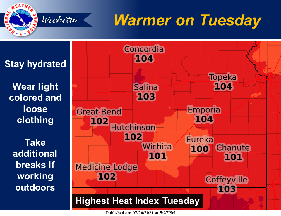
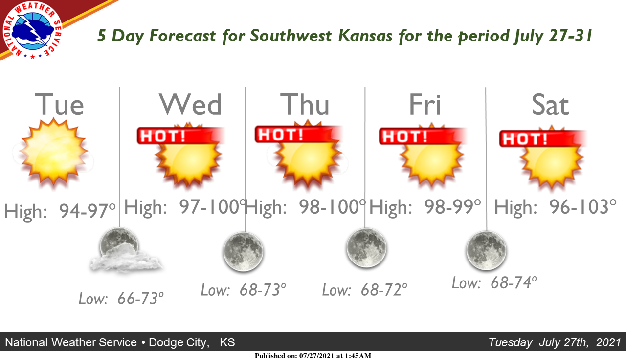
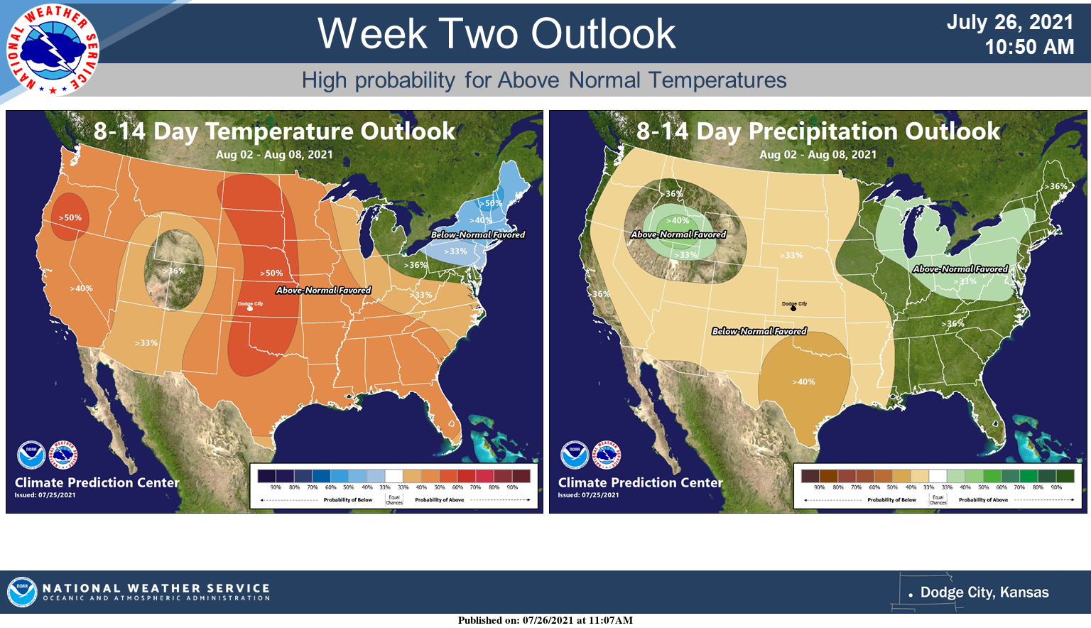
Finally, I am adding some more graphics from the Wichita and Dodge City NWS offices too.
HAVE A GOOD DAY!
MIKE