0355L-MONDAY UPDATE FROM ENID/GARFIELD COUNTY EMERGENCY MANAGEMENT-6/11/18
1- We are in a SLIGHT RISK for severe weather later today. Timing, per the graph is from roughly 4-10 pm. As of right now for Tuesday, we’ll be in a MARGINAL RISK.
2-We will be dealing with a cold front. It won’t cool things off too much BUT it will give us a chance for strong winds and hail both today and tomorrow. Everything depends on where it actually ends up both days. It is a slow mover and we all know what that means.
3- Overall, we’ll be ok so just be prepared for possibly heavy rainfall, strong winds and some hail.
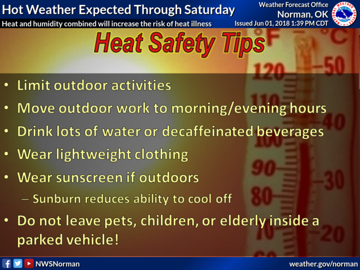
4- The HEAT will also be an issue so pace yourselves outside and stay hydrated.
5-Here is your forecast from the NWS/NORMAN;
Monday-30 percent chance of showers and thunderstorms after 4pm. Mostly sunny and hot, with a high near 99. Heat index values as high as 103. South wind 11 to 15 mph, with gusts as high as 21 mph.
Monday Night-30 percent chance of showers and thunderstorms before 1am. Mostly cloudy, with a low around 69. South wind 6 to 10 mph becoming north northeast after midnight.
HAVE A SUPER DAY!!
MIKE