FROM GARFIELD COUNTY EMERGENCY MANAGEMENT-MONDAY JUNE 12, 2017
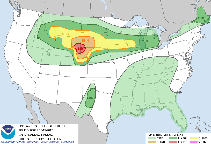
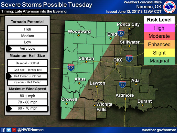
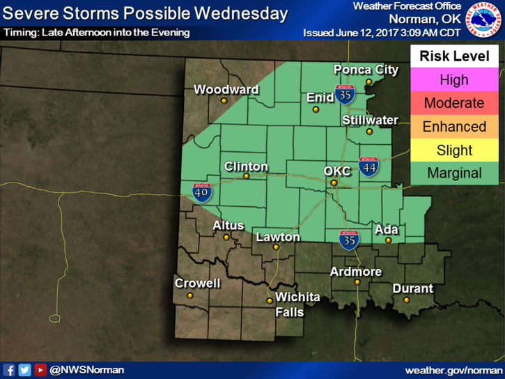
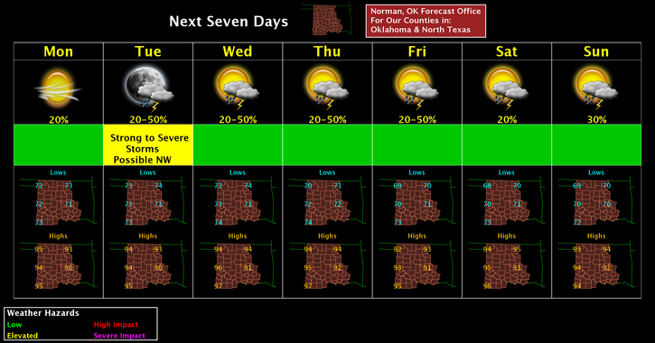
This is going to be a warm and windy week with chances for thunderstorms starting on Tuesday evening. Tuesday and Wednesday look to be MARGINAL RISK days but overall, we’ll see how everything comes together. What does everyone need to do? Just be prepared in case we do actually have a storm or two. The main risks appear to be hail and winds. See the graphs below. These graphs will change some today and tomorrow so don’t get fixated on where the lines are. Overall, we’ll be ok.
Since humidity is a factor this week, remember that if temps are in the low 90’s for instance, the heat index may be in the upper 90’s. Pace yourself if you work outside.
Here is your forecast from the NWS/NORMAN;
Monday: Sunny with a high near 94. Heat index values as high as 99. South winds 15 to 20 mph, with gusts as high as 25 mph.
Monday Night: Mostly clear with a low around 74. South winds 10 to 20 mph with gusts as high as 25 mph.
We’ll advise over our GARFIELD COUNTY EM app as needed.
HAVE A SUPER DAY!!
MIKE