0315L-MONDAY OUTLOOK FROM GARFIELD COUNTY EMERGENCY MANAGEMENT-6/28/21
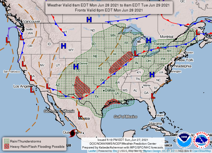
1- Cloudy with a 70% chance for additional rain and thunderstorms. The FLOOD WATCH was extended until this morning at 7am. It may be extended once again as conditions change. We will remain under the influence of the boundary that pushed through over the weekend. That boundary is expected to stall along the I-44 corridor this week and rain chances, especially to our south and southeast, will be higher.
2- IF YOU PLAN ON TRAVELING, we encourage you to take the time and check river reports as flooding is occurring in many areas around the state. This link will take you to a hydrograph monitoring page for rivers. It may be difficult to read but if you can read graphics, it’s not too hard. https://www.weather.gov/oun/hydro_ahpsmonitor
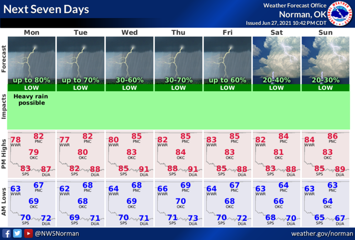
3- Overall, we’ll be ok. There may be breaks in the cloud cover. If that occurs, it may really become humid out there. Those that work outside, continue to stay hydrated. Here is your forecast from the NWS/NORMAN;
Today-Mostly cloudy. A chance of thunderstorms in the morning, then thunderstorms likely all afternoon. Highs in the lower 80s. Light and variable winds becoming east around 10 mph in the afternoon. Chance of thunderstorms 70 percent.
Tonight-Mostly cloudy. A chance of thunderstorms in the evening, then thunderstorms likely after midnight. Lows in the upper 60s. Light and variable winds. Chance of thunderstorms 70 percent.
Finally, be sure and download our GARFIELD COUNTY EM app. NWS advisories and warnings push through automatically along with info from us. You never know, this app just might save your life. It has to a few so far.
Have a good day!
MIKE