0400L-SUNDAY OUTLOOK FROM GARFIELD COUNTY EMERGENCY MANAGEMENT-6/27/21
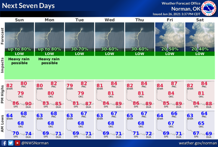
1-FLOOD WATCH until 6pm Sunday evening. Rain chances will continue off and on through the up and coming week. There may be a period or two of partly cloudy skies but we will remain cloudy most of the week. Highs will average in the low to mid 80s and overnight lows will average in the mid-60s. Winds will remain low around 10 mph for at least the next few days.
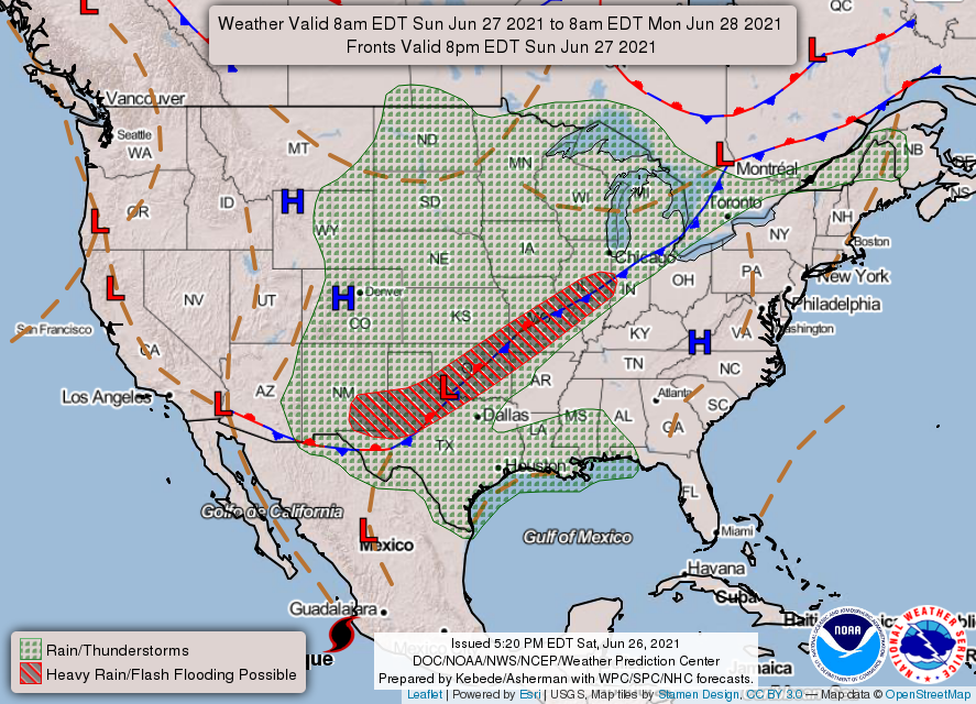
2- The front has pushed through the area but we are still anticipating rainfall at times during the day. The front is expected to stall in the I-44 corridor area and heavy rainfall will continue. There has been heavy rainfall overnight south and east of our county so if you decide to travel, keep in mind that these areas south and east may have received anywhere from 2-5 inches of rainfall and they are expecting more. Call ahead if you can and check weather conditions. Road conditions for the region can be found on our front page at www.gcem.org
3- Here is your countywide forecast from the NWS/NORMAN;
Today-Cloudy. Thunderstorms likely in the morning, then a chance of thunderstorms in the afternoon. Highs in the lower 80s. Light and variable winds. Chance of thunderstorms 70 percent.
Tonight-Mostly cloudy with a chance of thunderstorms. Lows in the mid-60s. Light and variable winds. Chance of thunderstorms 50 percent.
FINALLY, download our GARFIELD COUNTY EM app and you can find all sorts of preparedness and weather info on our website listed above.
HAVE A GOOD DAY!
MIKE