0405L-Monday Update from ENID/GARFIELD COUNTY EMERGENCY MANAGEMENT-6/4/18
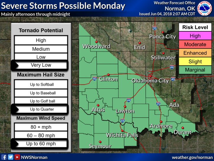
1-THERE IS A “POSSIBILITY” WE MAY SEE SOME THUNDERSTORM ACTIVITY THIS AFTERNOON INTO THE EVENING HOURS. A FEW COULD BE SEVERE WITH QUARTER HAIL AND WINDS TO 60 OR SO. AFTER TODAY AND TONIGHT, THE HEAT IS ON!!
2-We are not in a major risk area but if storms form, they could form into a MESO CONVECTIVE SYSTEM.
3-There is no need to worry about anything right now. We’ll keep an eye out and advise accordingly.
4- Here is your forecast from the NWS/NORMAN;
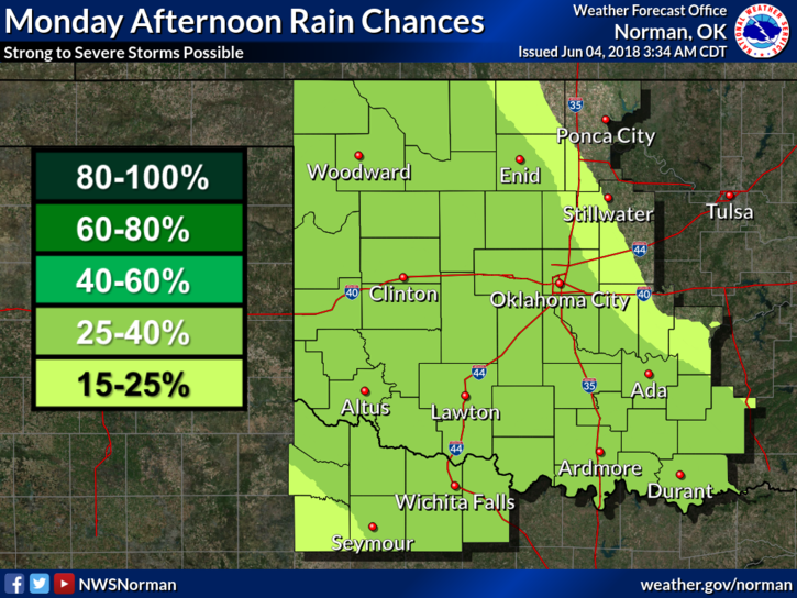
Monday-30 percent chance of showers and thunderstorms after 1pm. Partly sunny, with a high near 87. South southeast wind 5 to 15 mph, with gusts as high as 21 mph.
Monday Night-30 percent chance of showers and thunderstorms, mainly before 1am. Mostly cloudy, with a low around 62. Southeast wind 5 to 15 mph.
HAVE A SUPER DAY!!
MIKE