0415L-MONDAY OUTLOOK FROM GARFIELD COUNTY EMERGENCY MANAGEMENT-6/7/21
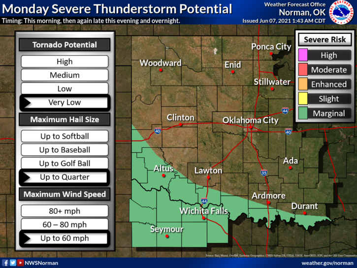
1- GENERAL THUNDERSTORM RISK ONCE AGAIN TODAY THROUGH WEDNESDAY. We don’t expect severe storms unless they develop outflow winds higher than 58 mph or 1 inch hail. The main area for severe weather still looks to be in southern Oklahoma so if you plan on traveling, stay aware of conditions in that area.
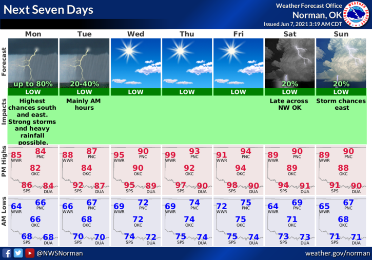
2- In Garfield County, expect partly cloudy conditions with a possibility of showers and or thunderstorms virtually any time during the day into tonight. Overall, we’ll be ok so stay weather aware. Here is your forecast from the NWS/NORMAN;
Today-Partly cloudy. A chance of thunderstorms in the morning, then a slight chance of thunderstorms in the afternoon. Highs in the mid-80s. Southeast winds around 10 mph. Chance of thunderstorms 50 percent.
Tonight-Partly cloudy. A slight chance of thunderstorms in the evening, then a chance of thunderstorms after midnight. Lows in the upper 60s. Southeast winds around 10 mph. Chance of thunderstorms 40 percent.
FINALLY, STORM SIREN 3 MINUTE TEST TODAY. It will occur at noon as long as we are clear or partly cloudy. If we are mostly cloudy with no rain falling, we will only do a voice test over the system.
HAVE A GOOD DAY!!
MIKE