0350L-MONDAY OUTLOOK & INFO FROM GARFIELD COUNTY EMERGENCY MGMT-6/8/2020
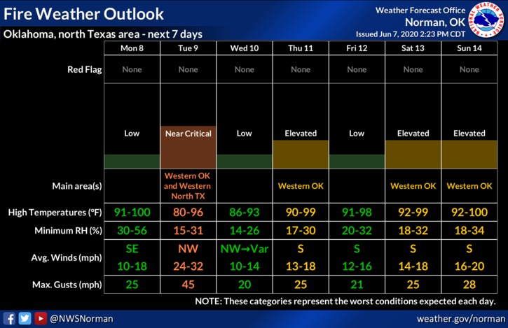
1- Continued hot and humid along with very dry conditions. The Fire Danger will increase without any rainfall. Help us with this by NOT throwing cigarette butts out the window and if you notice sparks from a chain, semi-trailer, or whatever, get their attention to shut down and fix the problem or call 911 to have them notify Law Enforcement & if fires are being started. We’ll have a front push through on Tuesday bringing with it very strong NW winds with some gusts possibly 45-50 mph. Dryer air will come with it as will a higher risk for fire. If you see smoke and or fire, call 911 immediately.
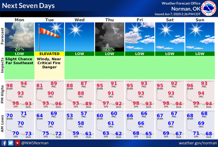
2-Overall a sunny and hot/humid day so enjoy. The front mentioned above will bring temps down into the low 90s on Tuesday & Wednesday. Here is your forecast from the NWS/NORMAN;
Today- Sunny with highs in the upper 90s. Southeast winds 10 to 15 mph.
Tonight- Clear with lows in the lower 70s. Southeast winds 10 to 15 mph.
HAVE A SUPER DAY!
MIKE