0440L-MONDAY OUTLOOK FROM GARFIELD COUNTY EMERGENCY MANAGEMENT-3/11/19
HIGH WIND WATCH IN EFFECT FROM WEDNESDAY MORNING THROUGH WEDNESDAY EVENING. WINDS 30-40 WITH GUSTS UPWARDS OF 60 MPH ARE POSSIBLE.
1- The sun will be hiding until later in the week as we will be dealing with clouds, humidity and rainfall. Forgot to mention the winds. The winds on Wednesday will make last Saturdays winds look moderate so take precautions around the home and business to secure anything that would take flight.
2- The next storm system has many questions yet to be resolved so I will wait to make any comments on that until newer data comes In after it reaches shore out west.
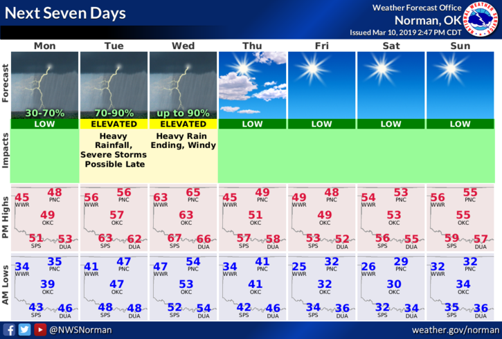
3- Here is your forecast from the NWS/NORMAN;
Today-20 percent chance of rain after 4pm. Cloudy, with a high near 49. Northeast wind around 7 mph.
Tonight-A chance of rain this evening and overnight. Low around 46. Southeast wind 6 to 8 mph. Chance of precipitation is 80%. New rainfall amounts between a tenth and quarter of an inch, except higher amounts possible in thunderstorms.
I will update this afternoon here and over the GARFIELD COUNTY EM app as needed.
MIKE