0405L-MONDAY UPDATE FROM ENID/GARFIELD COUNTY EMERGENCY MANAGEMENT-3/19/18
1- It rained and hailed alot. I received .6 of an inch here at the house. Let me know what you all received and if you took pics of the hail, post them here so we can check them out. Most of the hail was dime and nickel size but then the quarter and some larger fell. After seeing some pics sent directly to me, some looked to be near golf ball size. Keep up the good work, spotters to be!! J
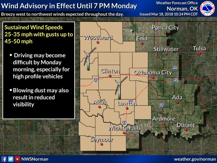
2- The winds will come up today and there is a WIND ADVISORY out west. If you are traveling that way, be extremely careful.
3-The week looks pretty good and the next chance for rain appears to be Friday evening through the weekend. Several variables there but more rain is definitely needed. We’ll see how the forecast verifies on this as the week progresses.
4- Download our app-GARFIELD COUNTY EM. Understand one key issue here; NWS WARNINGS AUTOMATICALLY COME THROUGH OUR APP. Special tones are coming with this in an update in the near future. In fact all info coming from us will have specific tones so you will know it’s from us. I will let you know when the update is close. I hope it’s sooner than later.
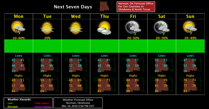
5- Here is your forecast from the NWS/NORMAN;
Today-Increasing clouds, with a high near 49. North northwest wind 10 to 15 mph increasing to 19 to 24 mph in the morning. Winds could gust as high as 33 mph.
Tonight-20 percent chance of rain before 1am. Cloudy, then gradually becoming partly cloudy, with a low around 34. North northwest wind 13 to 21 mph, with gusts as high as 29 mph.
HAVE A SUPER DAY!!
MIKE