0410L-TUESDAY UPDATE FROM ENID/GARFIELD COUNTY EMERGENCY MANAGEMENT-3/20/18
1-Clouds should give way to clear skies by this afternoon. If not, we will remain cooler today than forecast.
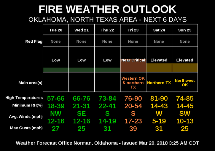
2-The fire danger will remain low for a few days due to higher humidity. It will increase by Friday BUT don’t let your guard down. Fire can still occur since we are still so dry. So dry I say? Here is a quick explanation; it rains, water soaks INTO the ground, foliage is still dead, winds dries out foliage, fire danger still there. Mud makes it difficult to get to the fire if it occurs. Welcome to our world!! J
3- We do have another storm system that will affect the area sometime late in the weekend but models are not in agreement. We’ll see what happens as we get closer to that timeframe.
4- I am working on a video to help some of you understand how our GARFIELD COUNTY EM app works. You can get this info on page 4, 5, 6, of our preparedness guide at this web address- https://gcem.org/wp-content/uploads/2017/08/Garfield-County-Family-Preparedness-Guide-2017.pdf
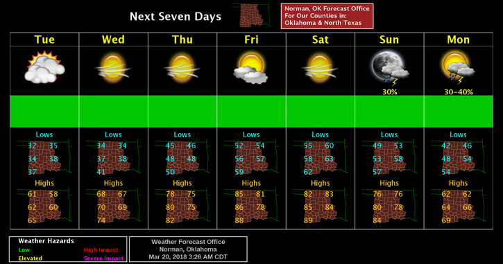
5- Here is your forecast from the NWS/NORMAN;
Tuesday-Partly sunny, then gradually becoming sunny, with a high near 59. North northwest wind 10 to 20 mph, with gusts as high as 25 mph.
Tuesday Night-Mostly clear, with a low around 35. North northwest wind 5 to 10 mph becoming light and variable after midnight.
HAVE A SUPER DAY!!
MIKE