0355L-MONDAY OUTLOOK & INFO FROM GARFIELD COUNTY EMERGENCY MGMT-3/2/2020
1- A weak cold front has pushed through the area during the overnight hours and we’ll have some gusty winds for a while. They should decrease through the afternoon hours. We will feel cooler as compared to this weekend but nothing dramatic.
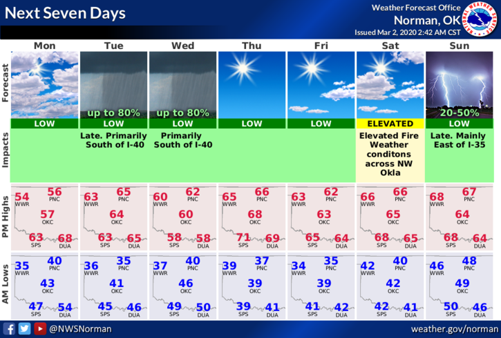
2- Rain chances for us look extremely low this week with an outside chance mid-week. Most rain should remain to our south. We’ll see how that works out.
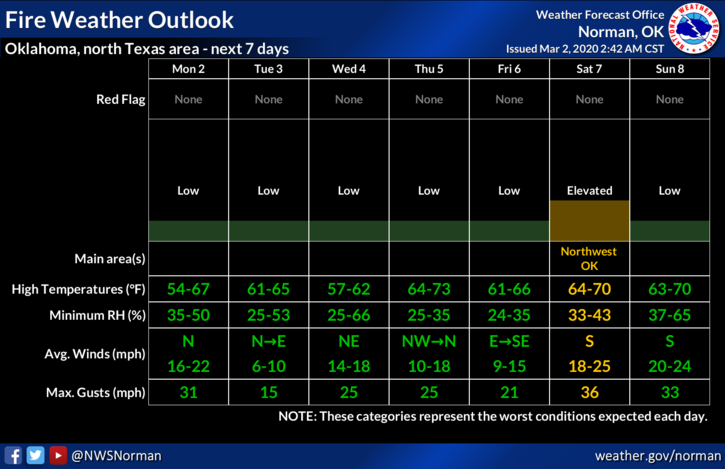
3- Yesterday, there were quite a few controlled burns going on and to my knowledge, nothing got out of control. Good job. Keep in mind that as the wind blows and we don’t receive any rain that foliage will dry out thus the FIRE DANGER will increase. Continue to report smoke and fire to 911 and keep an eye out for suspicious activity in which the Sheriff’s Office should be contacted.
4- Weather-wise, cooler today with gusty winds early but a really nice otherwise. Here is your official forecast from the NWS/NORMAN;
Monday-Partly sunny with a high near 56. North northeast wind 10 to 20 mph decreasing to 5 to 10 mph in the afternoon. Winds could gust as high as 25 mph.
Monday Night-Partly cloudy with a low around 37. North wind around 6 mph becoming light and variable.
HAVE A SUPER DAY!!
MIKE