0345L-SUNDAY OUTLOOK & INFO FROM GARFIELD COUNTY EMERGENCY MGMT-3/1/2020
1- It’s March now and I will ask again, do you have our GARFIELD COUNTY EM app? If not, you are not prepared for the spring storm season. Get it today from your app store and learn how it works. NWS warnings and advisories push through this app automatically and you’ll get LOCAL info from us as needed. You will need it and won’t have it, that’s your fault. It’s out there, go get it and rest assured you have the right info WHEN YOU NEED IT.
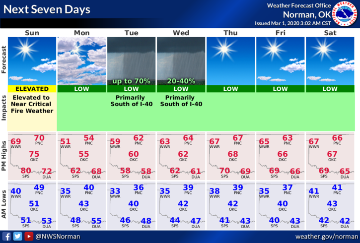
2-Weather-wise another warm day with southerly winds. We’ll have a trough push through and then a front later today and tonight. It appears that we may not see any rain with this, just a wind shift. We’ll see what happens. Get outside and enjoy the warmer temps as they will fall a little after the front pushes through.
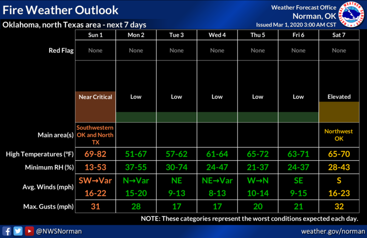
3- The FIRE DANGER is still around out there so be careful and if you see smoke or fire, call 911.
4- Here is your forecast from the NWS/NORMAN;
Sunday- Mostly sunny with a high near 71. South wind 10-16 mph becoming northwest in the afternoon. Winds could gust as high as 23 mph.
Sunday Night-Mostly clear with a low around 40. North wind 5 to 15 mph, with gusts as high as 23 mph.
HAVE A GOOD DAY!!
MIKE