0350L-MONDAY OUTLOOK FROM GARFIELD COUNTY EMERGENCY MANAGEMENT-3/22/21
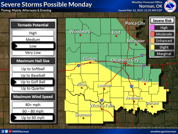
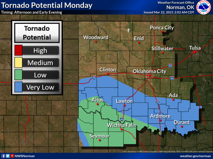
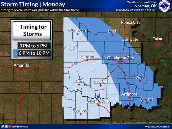
1-MARGINAL RISK for severe weather later today and tonight. Timing- 6 to 10 pm for storms. The tornado threat for us is very low. Hail and wind will be our main threats when storms arrive. All this is due to a storm system out west heading our way and another cold front that will push its way into the area. It may start raining during the day so just be ready for that too. This may change so stay tuned!
2- For those that don’t have our GARFIELD COUNTY EM app, today would be a good day to download it. You can stay informed from us at GCEM and the NWS. If you don’t have it, you’re not prepared. Remember- PREPAREDNESS = RESILIENCE
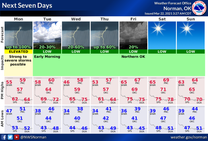
3- OVERALL, we’ll be ok so here is your forecast from the NWS/NORMAN;
Today-Cooler. Isolated thunderstorms in the morning. Rain showers through the day. A chance of thunderstorms in the afternoon. Highs in the upper 50s. Southeast winds 15 to 20 mph gusting to around 30 mph.
Tonight-Rain showers and a chance of thunderstorms in the evening, then a chance of rain showers and isolated thunderstorms after midnight. Lows in the lower 40s. South winds 10 to 20 mph.
HAVE A GOOD DAY AND WE’LL ADVISE AS NEEDED.
MIKE